Area Overview for BN3 3LP
Photos of BN3 3LP
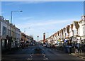
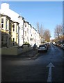
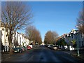
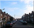
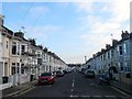
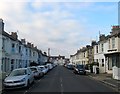
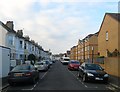
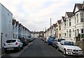
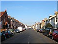
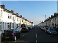
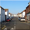
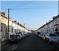
100 photos from this area
Area Information
Key information about the BN3 3LP including its size, population, and administrative classification.
- Area Type
- Postcode
- Area Size
- 3391 m²
- Population
- 1799
- Population Density
- 10792 people/km²
House Prices in BN3 3LP
25
Properties
£158,556
Average Sold Price
£73,000
Lowest Price
£258,000
Highest Price
Showing 25 properties
| Address | Type | Beds | Baths | Last Sale Price | Last Sale Date | |
|---|---|---|---|---|---|---|
| 46 Ellen Street, Hove, BN3 3LP | Flat | - | - | £258,000 | Jun 2021 | |
| 8 Ellen Street, Hove, BN3 3LP | Flat | - | - | £257,500 | Dec 2020 | |
| 20 Ellen Street, Hove, BN3 3LP | Flat | - | - | £187,500 | Jan 2019 | |
| 6 Ellen Street, Hove, BN3 3LP | Flat | - | - | £181,000 | Jun 2007 | |
| 28 Ellen Street, Hove, BN3 3LP | Flat | - | - | £113,000 | Jan 2006 | |
| 12 Ellen Street, Hove, BN3 3LP | Bungalow | - | - | £84,950 | Oct 2002 | |
| 42 Ellen Street, Hove, BN3 3LP | Flat | - | - | £113,500 | Sep 2002 | |
| 48 Ellen Street, Hove, BN3 3LP | Flat | 2 | 1 | £73,000 | Oct 2000 | |
| 40 Ellen Street, Hove, BN3 3LP | Flat | - | - | - | - | |
| 30 Ellen Street, Hove, BN3 3LP | Flat | - | - | - | - |
Page 1 of 3
Energy Efficiency in BN3 3LP
Amenities
Schools
| Rank | School | Type | Entry gender | Ages |
|---|
Explore more schools in this area
Go to Schools tabDemographics
Household Size
One person
most common
Accommodation Type
Flats
most common
Tenure
29
majority
Ethnic Group
White
most common
Religion
N/A
most common
Household Composition
N/A
most common
Age
47
median
Adults (30-64 years)
most common
Household Deprivation
N/A
with no deprivation
NS-SEC
39
in Lower managerial occupations
Explore more demographic insights in this area
Go to Demographics tabPlanning
Planning Constraints
- Flood RiskPremium
- Ramsar Wetland SitesPremium
- Area of Outstanding Natural BeautyPremium
- Protected Nature ReservePremium
- Protected WoodlandPremium