Area Overview for BN3 3FQ
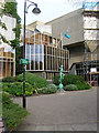
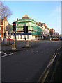
Photos of BN3 3FQ


Area Information
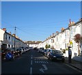
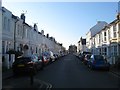
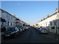
BN3 3FQ is a small residential postcode cluster nestled in the Hove area of Brighton and Hove, England. With a population of 1,514, it forms part of the Westbourne & Poets’ Corner electoral ward, a community known for its stable demographics and proximity to local amenities. The area is characterised by a mature population, with a median age of 47 and a majority of residents aged 30–64. This suggests a community rooted in long-term residency, likely with families and professionals seeking a quieter, established environment. The housing stock here is predominantly flats, reflecting a mix of older properties and newer developments. While the area is compact, it benefits from nearby rail links and retail hubs, offering a balance between residential tranquillity and practical connectivity. Living in BN3 3FQ means being part of a tight-knit neighbourhood with access to essential services, though its small size means it is best suited for those prioritising convenience over expansive space.
- Area Type
- Postcode
- Area Size
- Not available
- Population
- Not available
- Population Density
- Not available
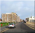
The property market in BN3 3FQ is defined by a 52% home ownership rate, suggesting that nearly half of the housing stock is owner-occupied, while the remaining properties are likely rented. The predominant accommodation type here is flats, which may indicate a focus on smaller, more manageable living spaces. This is typical of areas with older housing stock or developments designed for urban living. For buyers, this means a limited supply of larger homes, with flats forming the bulk of available options. The small size of the postcode area means that property searches should extend to nearby neighbourhoods for more variety. The flat-dominated market may appeal to those seeking affordability or proximity to amenities, but buyers should consider the potential for limited space and the need for proximity to transport links.
House Prices in BN3 3FQ
No properties found in this postcode.
Energy Efficiency in BN3 3FQ
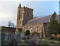
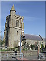
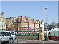
The lifestyle in BN3 3FQ is shaped by its proximity to essential amenities. Within practical reach are retail outlets such as Tesco Hove, Co-op Hove, and Iceland Hove, ensuring residents have access to grocery and daily needs. The area’s rail stations connect to major transport hubs, facilitating travel to nearby towns and cities. While there are no parks or leisure facilities listed in the immediate vicinity, the presence of multiple rail stations and airports suggests a focus on mobility over local recreation. The character of the area is defined by its practicality, with shops and transport options prioritised over expansive green spaces. This makes BN3 3FQ ideal for those seeking convenience and connectivity, though those valuing outdoor amenities may need to look beyond the immediate postcode.
Amenities
Schools
The nearest school to BN3 3FQ is Brighton and Hove Clinic School, a special school with an Ofsted rating of outstanding. This indicates a high standard of education tailored to students with specific needs. While the area lacks mainstream primary or secondary schools, the presence of a special school suggests that families with children requiring specialist support may find this a key factor in their decision to live here. The absence of other schools in the immediate vicinity means that families without children with special educational needs may need to look further afield for mainstream schooling. However, the outstanding rating at Clinic School provides reassurance for those prioritising quality in educational provision.
| Rank | School | Type | Entry gender | Ages |
|---|
Explore more schools in this area
Go to Schools tabDemographics
The residents of BN3 3FQ are predominantly adults aged 30–64, with a median age of 47. This suggests a community with a strong presence of middle-aged professionals and families, likely settled in the area for the long term. Home ownership stands at 52%, indicating a mix of owner-occupied and rental properties. The accommodation type is largely flats, which may reflect the area’s compact nature and historical development patterns. The predominant ethnic group is White, though specific data on diversity is not provided. The age profile implies a stable, low-turnover population, which can contribute to a cohesive community feel. However, the absence of detailed information on deprivation or income levels means the quality of life implications of these demographics remain partially unexplored.
Household Size
Accommodation Type
Tenure
Ethnic Group
Religion
Household Composition
Age
Household Deprivation
NS-SEC
Explore more demographic insights in this area
Go to Demographics tabPlanning
Planning Constraints
- Flood RiskPremium
- Ramsar Wetland SitesPremium
- Area of Outstanding Natural BeautyPremium
- Protected Nature ReservePremium
- Protected WoodlandPremium