Area Overview for BN3 2RE
Photos of BN3 2RE
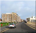
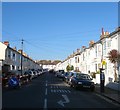
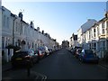
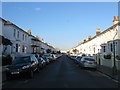


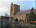
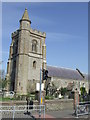
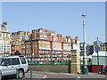
100 photos from this area
Area Information
Key information about the BN3 2RE including its size, population, and administrative classification.
- Area Type
- Postcode
- Area Size
- 3429 m²
- Population
- 1463
- Population Density
- 17252 people/km²
House Prices in BN3 2RE
37
Properties
£481,273
Average Sold Price
£38,000
Lowest Price
£1,250,000
Highest Price
Showing 37 properties
| Address | Type | Beds | Baths | Last Sale Price | Last Sale Date | |
|---|---|---|---|---|---|---|
| Basement Flat, 4 Osborne Villas, Hove, BN3 2RE | Semi-detached | 4 | 2 | £1,250,000 | May 2025 | |
| 16 Osborne Villas, Hove, BN3 2RE | Flat | 4 | 2 | £836,000 | Jun 2024 | |
| 8 Osborne Villas, Hove, BN3 2RE | Semi-detached | 4 | 2 | £1,000,000 | Jun 2024 | |
| 14A Osborne Villas, Hove, BN3 2RE | Flat | 1 | 1 | £385,000 | Oct 2022 | |
| 26A Osborne Villas, Hove, BN3 2RE | Flat | 1 | 1 | £285,000 | Jun 2020 | |
| 6 Osborne Villas, Hove, BN3 2RE | Flat | 2 | 1 | £622,500 | Oct 2011 | |
| 32A Osborne Villas, Hove, BN3 2RE | Flat | 1 | - | £168,000 | Aug 2011 | |
| 28 Osborne Villas, Hove, BN3 2RE | Detached | - | - | £337,500 | Sep 2001 | |
| 18 Osborne Villas, Hove, BN3 2RE | Detached | - | - | £228,000 | Apr 1999 | |
| Ground Floor And First Floor Flat, 4 Osborne Villas, Hove, BN3 2RE | Flat | - | - | £38,000 | Apr 1999 |
Page 1 of 4
Energy Efficiency in BN3 2RE
Amenities
Schools
| Rank | School | Type | Entry gender | Ages |
|---|
Explore more schools in this area
Go to Schools tabDemographics
Household Size
One person
most common
Accommodation Type
Flats
most common
Tenure
37
majority
Ethnic Group
White
most common
Religion
N/A
most common
Household Composition
N/A
most common
Age
47
median
Adults (30-64 years)
most common
Household Deprivation
N/A
with no deprivation
NS-SEC
48
in Lower managerial occupations
Explore more demographic insights in this area
Go to Demographics tabPlanning
Planning Constraints
- Flood RiskPremium
- Ramsar Wetland SitesPremium
- Area of Outstanding Natural BeautyPremium
- Protected Nature ReservePremium
- Protected WoodlandPremium