Area Overview for BN3 2QX
Photos of BN3 2QX
Area Information
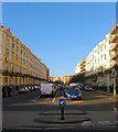
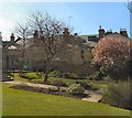
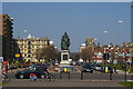
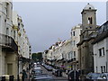
Living in BN3 2QX means residing within a specific residential cluster on the Sussex coast. This postcode covers an area of 419 m² and serves a population of 1,388 residents. The location sits within the Central Hove electoral ward, part of Brighton and Hove City Council. You are situated in a neighbourhood defined by proximity to key local hubs rather than vast open spaces. Daily life here centres around practical access to services. The ward forms part of the Hove and Portslade parliamentary constituency. This small footprint creates a close-knit environment where residents interact frequently with their immediate neighbours. The area functions as a residential anchor within the larger South East region of England.Ownership patterns here reflect a community stable enough for long-term families. The setting offers a direct connection to the surrounding amenities without the congestion of larger city centres. You gain a foothold in a district known for its specific connectivity to transport links. The character of BN3 2QX is shaped by its housing stock and the people who call it home. Exploration of this area reveals a balance between quiet domesticity and convenient access to urban facilities. The ward elects two councillors who represent these specific interests. Life here prioritises efficiency and safety.
- Area Type
- Postcode
- Area Size
- 419 m²
- Population
- 1388
- Population Density
- 8830 people/km²
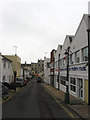
The property market in BN3 2QX is characterised by a mix of tenancy models and specific housing styles. Flats dominate the stock, reflecting the compact nature of a 419 m² area designed for a population of 1,388. Home ownership stands at 54%, while the remaining 46% of residents likely rent their properties. This split indicates a diverse market suitable for both investors and owner-occupiers seeking a flat. You will find a variety of accommodation types rather than detached houses or large villas. The small scale of the postcode means supply is limited, potentially increasing demand when new units appear. Prospective buyers considering homes in this area should expect condominium or apartment-style living. Ownership provides security in an area with a modest crime risk score of 69. For renters, the proximity to Central Hove offers access to leaseholds linked to the broader residential cluster. The density of 3,309,413 people per square kilometre highlights the intensity of the local housing stock. This concentration supports active community management and shared responsibilities among neighbours. The market functions as a micro-economy independent of larger neighbourhoods. Stability prevails here, driven by the age profile of the most common residents aged 30 to 64.
House Prices in BN3 2QX
Showing 72 properties
Energy Efficiency in BN3 2QX
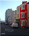
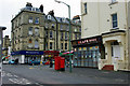
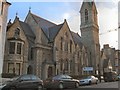
Your daily lifestyle in BN3 2QX centres on the amenities found within practical reach of the postcode. Five retail outlets operate nearby, including Cook Hove, Budgens Church, and Co-op Hove. Shopping runs are straightforward and accessible from your doorstep. Five railway stations provide transport links, ensuring you can reach Hove, Aldrington, or Preston Park by foot. Two airports, Shoreham Brighton City Airport and Shoreham Airport, sit close by for leisure travel. Dining and socialising happen in nearby Central Hove, where Church Road hosts numerous restaurants, cafes, pubs, and bars. This high street contributes to a vibrant atmosphere for weekends and evenings. Cocooning within the 419 m² area gives peace at night, while morning errands benefit from the local shops. Five categories of amenities support a full range of daily needs. The presence of supermarkets allows for fresh groceries without long drives. The mix of transport hubs offers flexibility whether you commute by train or catch a flight. Living in this area provides access to essential services without the noise of the city centre. You enjoy the convenience of a bustling local environment while maintaining a quiet residential home.
Amenities
Schools
| Rank | School | Type | Entry gender | Ages |
|---|
Explore more schools in this area
Go to Schools tabDemographics
The community in BN3 2QX reflects a settled, mature population structure. The median age stands at 47 years, placing the area firmly within a demographic of established families and individuals. Adults aged between 30 and 64 years represent the most common age range. This profile suggests a neighbourhood where residents have likely put down roots and prioritise stability. Home ownership accounts for 54% of households, indicating that the majority of people own their property outright or with a mortgage. Flats form the predominant accommodation type within this specific cluster. The predominant ethnic group is White, aligning with the broader demographics of the Brighton and Hove region. Safety scores indicate a crime risk level of 69 out of 100, which falls below the national average. This low crime rating supports a secure environment for raising children or enjoying retirement living. The area does not suffer from significant flood risk or planning constraints such as protected woodlands or nature reserves. Environmental assessments show zero risk scores for Ramsar wetland sites and areas of outstanding natural beauty. These factors combine to create a predictable living situation without unexpected regulatory hurdles for owners.
Household Size
Accommodation Type
Tenure
Ethnic Group
Religion
Household Composition
Age
Household Deprivation
NS-SEC
Explore more demographic insights in this area
Go to Demographics tabPlanning
Planning Constraints
- Flood RiskPremium
- Ramsar Wetland SitesPremium
- Area of Outstanding Natural BeautyPremium
- Protected Nature ReservePremium
- Protected WoodlandPremium