Area Overview for BN3 2FB
Photos of BN3 2FB
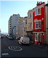
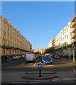
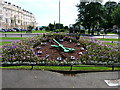
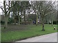
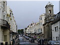

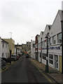

100 photos from this area
Area Information
Key information about the BN3 2FB including its size, population, and administrative classification.
- Area Type
- Postcode
- Area Size
- 1.0 hectares
- Population
- Not available
- Population Density
- Not available
House Prices in BN3 2FB
80
Properties
£498,746
Average Sold Price
£59,000
Lowest Price
£1,635,000
Highest Price
Showing 80 properties
| Address | Type | Beds | Baths | Last Sale Price | Last Sale Date | |
|---|---|---|---|---|---|---|
| 9 St Johns Road, Hove, BN3 2FB | Terraced | 6 | 2 | £760,000 | Sep 2025 | |
| Flat 2, 2 St Johns Road, Hove, BN3 2FB | Flat | 4 | - | £300,000 | Feb 2025 | |
| 33 St Johns Road, Hove, BN3 2FB | Semi-detached | 3 | 1 | £760,000 | Jun 2022 | |
| 29 St Johns Road, Hove, BN3 2FB | house | - | - | £1,635,000 | Jun 2022 | |
| 2A St Johns Road, Hove, BN3 2FB | Flat | 2 | 1 | £530,000 | Jun 2021 | |
| 4A St Johns Road, Hove, BN3 2FB | house | - | - | £785,000 | Aug 2017 | |
| 35 St Johns Road, Hove, BN3 2FB | Detached | 4 | 2 | £645,000 | Feb 2017 | |
| Adelaide Cottage, St Johns Road, Hove, BN3 2FB | Semi-detached | 3 | 1 | £425,000 | Feb 2016 | |
| 21A St Johns Road, Hove, BN3 2FB | Terraced | 3 | - | £500,000 | Sep 2015 | |
| 7 St Johns Road, Hove, BN3 2FB | Terraced | 3 | 2 | £707,000 | Mar 2015 |
Page 1 of 8
Energy Efficiency in BN3 2FB
Amenities
Schools
| Rank | School | Type | Entry gender | Ages |
|---|
Explore more schools in this area
Go to Schools tabDemographics
Household Size
One person
most common
Accommodation Type
Flats
most common
Tenure
43
majority
Ethnic Group
White
most common
Religion
N/A
most common
Household Composition
N/A
most common
Age
47
median
Adults (30-64 years)
most common
Household Deprivation
N/A
with no deprivation
NS-SEC
51
in Lower managerial occupations
Explore more demographic insights in this area
Go to Demographics tabPlanning
Planning Constraints
- Flood RiskPremium
- Ramsar Wetland SitesPremium
- Area of Outstanding Natural BeautyPremium
- Protected Nature ReservePremium
- Protected WoodlandPremium