Area Overview for BN27 4PU
Photos of BN27 4PU
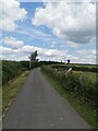
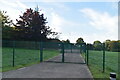
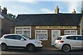
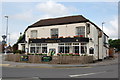
71 photos from this area
Area Information
Key information about the BN27 4PU including its size, population, and administrative classification.
- Area Type
- Postcode
- Area Size
- 1.7 hectares
- Population
- 1611
- Population Density
- 889 people/km²
House Prices in BN27 4PU
18
Properties
£178,044
Average Sold Price
£66,666
Lowest Price
£315,000
Highest Price
Showing 18 properties
| Address | Type | Beds | Baths | Last Sale Price | Last Sale Date | |
|---|---|---|---|---|---|---|
| 13 Chestnut Close, Herstmonceux, BN27 4PU | Terraced | 3 | 1 | £310,000 | Jun 2025 | |
| 9 Chestnut Close, Herstmonceux, BN27 4PU | house | - | - | £315,000 | Feb 2022 | |
| 12 Chestnut Close, Herstmonceux, BN27 4PU | Semi-detached | 3 | 1 | £268,000 | Jul 2020 | |
| 7 Chestnut Close, Herstmonceux, BN27 4PU | Semi-detached | 3 | 2 | £227,000 | Dec 2016 | |
| 1 Chestnut Close, Herstmonceux, BN27 4PU | house | - | - | £172,000 | Aug 2011 | |
| 19 Chestnut Close, Herstmonceux, BN27 4PU | Terraced | - | - | £263,000 | Oct 2006 | |
| 3 Chestnut Close, Herstmonceux, BN27 4PU | Semi-detached | - | - | £179,000 | Sep 2004 | |
| 6 Chestnut Close, Herstmonceux, BN27 4PU | Terraced | - | - | £130,950 | Jun 2002 | |
| 5 Chestnut Close, Herstmonceux, BN27 4PU | Semi-detached | - | - | £128,000 | May 2002 | |
| 11 Chestnut Close, Herstmonceux, BN27 4PU | Semi-detached | - | - | £117,000 | Mar 2001 |
Page 1 of 2
Energy Efficiency in BN27 4PU
Amenities
Schools
| Rank | School | Type | Entry gender | Ages |
|---|
Explore more schools in this area
Go to Schools tabDemographics
Household Size
Two person
most common
Accommodation Type
Houses
most common
Tenure
73
majority
Ethnic Group
White
most common
Religion
N/A
most common
Household Composition
N/A
most common
Age
47
median
Adults (30-64 years)
most common
Household Deprivation
N/A
with no deprivation
NS-SEC
31
in Lower managerial occupations
Explore more demographic insights in this area
Go to Demographics tabPlanning
Planning Constraints
- Flood RiskPremium
- Ramsar Wetland SitesPremium
- Area of Outstanding Natural BeautyPremium
- Protected Nature ReservePremium
- Protected WoodlandPremium