Area Overview for BN27 4LB
Photos of BN27 4LB
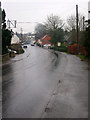
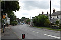
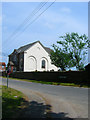
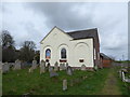
71 photos from this area
Area Information
Key information about the BN27 4LB including its size, population, and administrative classification.
- Area Type
- Postcode
- Area Size
- 3286 m²
- Population
- 1611
- Population Density
- 889 people/km²
House Prices in BN27 4LB
10
Properties
£242,500
Average Sold Price
£215,000
Lowest Price
£270,000
Highest Price
Showing 10 properties
| Address | Type | Beds | Baths | Last Sale Price | Last Sale Date | |
|---|---|---|---|---|---|---|
| The Old Clock House, Gardner Street, Herstmonceux, BN27 4LB | Semi-detached | 3 | 2 | £270,000 | Apr 2018 | |
| The Old Sweet Factory, Gardner Street, Herstmonceux, BN27 4LB | Semi-detached | 3 | 1 | £215,000 | Dec 1999 | |
| Flat, The Old Cobblers Shop, Gardner Street, Herstmonceux, BN27 4LB | Industrial | 2 | 1 | - | - | |
| 1, Carriers Cottage, West End, Herstmonceux, BN27 4LB | Semi-detached | - | - | - | - | |
| Flat, The Old Clock Shop, Gardner Street, Herstmonceux, BN27 4LB | Flat | 3 | 1 | - | - | |
| The Bank Flat, Gardner Street, Herstmonceux, BN27 4LB | Cottage | 1 | 1 | - | - | |
| Living Accommodation, The Brewers Arms, Gardner Street, Herstmonceux, BN27 4LB | Flat | - | - | - | - | |
| Briars Cottage, Gardner Street, Herstmonceux, BN27 4LB | Detached | - | - | - | - | |
| Herkymoo Barbers, Briars Cottage, Gardner Street, Herstmonceux, BN27 4LB | shop | - | - | - | - | |
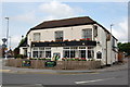
| The Brewers Arms, Gardner Street, Herstmonceux, BN27 4LB | Leisure | - | - | - | - |
Energy Efficiency in BN27 4LB
Amenities
Schools
| Rank | School | Type | Entry gender | Ages |
|---|
Explore more schools in this area
Go to Schools tabDemographics
Household Size
Two person
most common
Accommodation Type
Houses
most common
Tenure
73
majority
Ethnic Group
White
most common
Religion
N/A
most common
Household Composition
N/A
most common
Age
47
median
Adults (30-64 years)
most common
Household Deprivation
N/A
with no deprivation
NS-SEC
31
in Lower managerial occupations
Explore more demographic insights in this area
Go to Demographics tabPlanning
Planning Constraints
- Flood RiskPremium
- Ramsar Wetland SitesPremium
- Area of Outstanding Natural BeautyPremium
- Protected Nature ReservePremium
- Protected WoodlandPremium