Area Overview for BN27 3UW
Photos of BN27 3UW
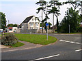
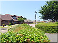
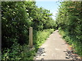
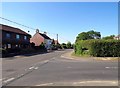
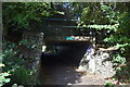
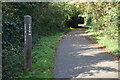
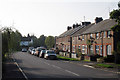
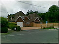
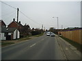
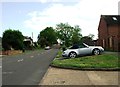
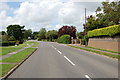
22 photos from this area
Area Information
Key information about the BN27 3UW including its size, population, and administrative classification.
- Area Type
- Postcode
- Area Size
- 3.9 hectares
- Population
- 1464
- Population Density
- 1267 people/km²
House Prices in BN27 3UW
14
Properties
£253,158
Average Sold Price
£76,000
Lowest Price
£540,000
Highest Price
Showing 14 properties
| Address | Type | Beds | Baths | Last Sale Price | Last Sale Date | |
|---|---|---|---|---|---|---|
| 11 Dunbar Drive, Hailsham, BN27 3UW | Detached | 5 | 3 | £540,000 | Jun 2023 | |
| 5 Dunbar Drive, Hailsham, BN27 3UW | house | - | - | £350,000 | Oct 2020 | |
| 6 Dunbar Drive, Hailsham, BN27 3UW | Detached | 4 | 2 | £330,000 | Jul 2018 | |
| 14 Dunbar Drive, Hailsham, BN27 3UW | house | - | - | £315,000 | Jun 2018 | |
| 9 Dunbar Drive, Hailsham, BN27 3UW | house | - | - | £247,000 | Oct 2012 | |
| 16 Dunbar Drive, Hailsham, BN27 3UW | house | - | - | £235,000 | Dec 2010 | |
| 2 Dunbar Drive, Hailsham, BN27 3UW | house | - | - | £320,000 | Nov 2006 | |
| 10 Dunbar Drive, Hailsham, BN27 3UW | Detached | - | - | £272,000 | Mar 2006 | |
| 7 Dunbar Drive, Hailsham, BN27 3UW | house | - | - | £149,950 | Apr 2002 | |
| 8 Dunbar Drive, Hailsham, BN27 3UW | Detached | - | - | £95,000 | Apr 1997 |
Page 1 of 2
Energy Efficiency in BN27 3UW
Amenities
Schools
| Rank | School | Type | Entry gender | Ages |
|---|
Explore more schools in this area
Go to Schools tabDemographics
Household Size
Two person
most common
Accommodation Type
Houses
most common
Tenure
81
majority
Ethnic Group
White
most common
Religion
N/A
most common
Household Composition
N/A
most common
Age
47
median
Adults (30-64 years)
most common
Household Deprivation
N/A
with no deprivation
NS-SEC
32
in Lower managerial occupations
Explore more demographic insights in this area
Go to Demographics tabPlanning
Planning Constraints
- Flood RiskPremium
- Ramsar Wetland SitesPremium
- Area of Outstanding Natural BeautyPremium
- Protected Nature ReservePremium
- Protected WoodlandPremium