Area Overview for BN27 3FZ
Photos of BN27 3FZ
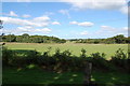
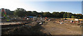
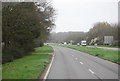
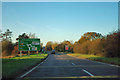
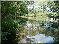
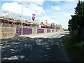
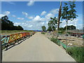
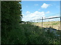
15 photos from this area
Area Information
Key information about the BN27 3FZ including its size, population, and administrative classification.
- Area Type
- Postcode
- Area Size
- 4.3 hectares
- Population
- 1834
- Population Density
- 4557 people/km²
House Prices in BN27 3FZ
79
Properties
£285,608
Average Sold Price
£129,000
Lowest Price
£585,000
Highest Price
Showing 79 properties
| Address | Type | Beds | Baths | Last Sale Price | Last Sale Date | |
|---|---|---|---|---|---|---|
| 52 Hedley Way, Hailsham, BN27 3FZ | Terraced | 3 | 2 | £343,000 | Jul 2025 | |
| 72 Hedley Way, Hailsham, BN27 3FZ | Detached | 4 | 2 | £470,000 | Jun 2025 | |
| 31 Hedley Way, Hailsham, BN27 3FZ | Terraced | 3 | 2 | £310,000 | May 2025 | |
| 25 Hedley Way, Hailsham, BN27 3FZ | Flat | 2 | 1 | £235,000 | Mar 2025 | |
| 15 Hedley Way, Hailsham, BN27 3FZ | Semi-detached | 3 | 2 | £320,000 | Nov 2024 | |
| 56 Hedley Way, Hailsham, BN27 3FZ | Semi-detached | 4 | 3 | £425,000 | Nov 2024 | |
| 30 Hedley Way, Hailsham, BN27 3FZ | house | - | - | £440,000 | Jun 2024 | |
| 32 Hedley Way, Hailsham, BN27 3FZ | Detached | 4 | 3 | £415,000 | May 2024 | |
| 10 Hedley Way, Hailsham, BN27 3FZ | house | - | - | £315,000 | Apr 2024 | |
| 29 Hedley Way, Hailsham, BN27 3FZ | Terraced | 3 | 2 | £300,000 | Jan 2024 |
Page 1 of 8
Energy Efficiency in BN27 3FZ
Amenities
Schools
| Rank | School | Type | Entry gender | Ages |
|---|
Explore more schools in this area
Go to Schools tabDemographics
Household Size
Family (3-5 people)
most common
Accommodation Type
Houses
most common
Tenure
76
majority
Ethnic Group
White
most common
Religion
N/A
most common
Household Composition
N/A
most common
Age
47
median
Adults (30-64 years)
most common
Household Deprivation
N/A
with no deprivation
NS-SEC
37
in Lower managerial occupations
Explore more demographic insights in this area
Go to Demographics tabPlanning
Planning Constraints
- Flood RiskPremium
- Ramsar Wetland SitesPremium
- Area of Outstanding Natural BeautyPremium
- Protected Nature ReservePremium
- Protected WoodlandPremium