Area Overview for BN27 2ED
Photos of BN27 2ED
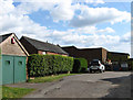
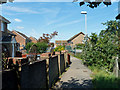
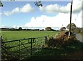
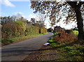
37 photos from this area
Area Information
Key information about the BN27 2ED including its size, population, and administrative classification.
- Area Type
- Postcode
- Area Size
- 1875 m²
- Population
- Not available
- Population Density
- Not available
House Prices in BN27 2ED
6
Properties
£277,983
Average Sold Price
£164,950
Lowest Price
£395,000
Highest Price
Showing 6 properties
| Address | Type | Beds | Baths | Last Sale Price | Last Sale Date | |
|---|---|---|---|---|---|---|
| Lyndhurst, 65 Station Road, Hailsham, BN27 2ED | house | 3 | 1 | £365,000 | Jul 2022 | |
| 63 Station Road, Hailsham, BN27 2ED | Detached | 3 | 1 | £395,000 | May 2022 | |
| 59 Station Road, Hailsham, BN27 2ED | Bungalow | 2 | 1 | £260,000 | May 2021 | |
| Cameo Cottage, 61 Station Road, Hailsham, BN27 2ED | Bungalow | 3 | - | £293,000 | Aug 2015 | |
| 67 Station Road, Hailsham, BN27 2ED | Terraced | 3 | 1 | £189,950 | May 2014 | |
| 69 Station Road, Hailsham, BN27 2ED | house | - | - | £164,950 | Sep 2005 |
Energy Efficiency in BN27 2ED
Amenities
Schools
| Rank | School | Type | Entry gender | Ages |
|---|
Explore more schools in this area
Go to Schools tabDemographics
Household Size
Two person
most common
Accommodation Type
Houses
most common
Tenure
57
majority
Ethnic Group
White
most common
Religion
N/A
most common
Household Composition
N/A
most common
Age
47
median
Adults (30-64 years)
most common
Household Deprivation
N/A
with no deprivation
NS-SEC
24
in Lower managerial occupations
Explore more demographic insights in this area
Go to Demographics tabPlanning
Planning Constraints
- Flood RiskPremium
- Ramsar Wetland SitesPremium
- Area of Outstanding Natural BeautyPremium
- Protected Nature ReservePremium
- Protected WoodlandPremium