Area Overview for BN27 1QL
Photos of BN27 1QL
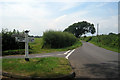
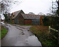
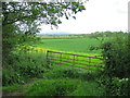
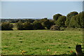
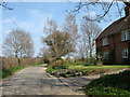
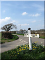
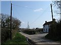
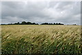
34 photos from this area
Area Information
Key information about the BN27 1QL including its size, population, and administrative classification.
- Area Type
- Postcode
- Area Size
- 8.2 hectares
- Population
- 1315
- Population Density
- 48 people/km²
House Prices in BN27 1QL
6
Properties
£270,499
Average Sold Price
£99,498
Lowest Price
£545,000
Highest Price
Showing 6 properties
| Address | Type | Beds | Baths | Last Sale Price | Last Sale Date | |
|---|---|---|---|---|---|---|
| Coopers Croft Cottage, Cricketing Lane, Herstmonceux, BN27 1QL | Detached | 6 | 2 | £545,000 | Jan 2024 | |
| Monks Rest, Hailsham Road, Herstmonceux, BN27 1QL | Detached | - | - | £167,000 | Nov 1999 | |
| Truggery Cottage, Hailsham Road, Herstmonceux, BN27 1QL | Detached | - | - | £99,498 | Jul 1995 | |
| Wavern Cottage, Cricketing Lane, Herstmonceux, BN27 1QL | Detached | 6 | 2 | - | - | |
| Hazeldene, Cricketing Lane, Herstmonceux, BN27 1QL | Retail | 3 | 2 | - | - | |
| Cherry Tree Cottage, Cricketing Lane, Herstmonceux, BN27 1QL | Detached | - | - | - | - |
Energy Efficiency in BN27 1QL
Amenities
Schools
| Rank | School | Type | Entry gender | Ages |
|---|
Explore more schools in this area
Go to Schools tabDemographics
Household Size
Two person
most common
Accommodation Type
Houses
most common
Tenure
88
majority
Ethnic Group
White
most common
Religion
N/A
most common
Household Composition
N/A
most common
Age
47
median
Adults (30-64 years)
most common
Household Deprivation
N/A
with no deprivation
NS-SEC
39
in Lower managerial occupations
Explore more demographic insights in this area
Go to Demographics tabPlanning
Planning Constraints
- Flood RiskPremium
- Ramsar Wetland SitesPremium
- Area of Outstanding Natural BeautyPremium
- Protected Nature ReservePremium
- Protected WoodlandPremium