Area Overview for BN27 1NJ
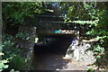
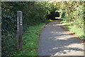
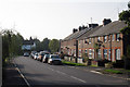
Photos of BN27 1NJ
Area Information
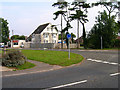
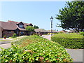
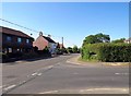
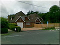
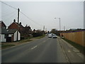
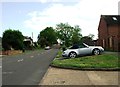
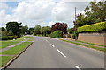
The postcode sector BN27 1NJ is a compact residential cluster covering just 584 square metres. It sits within the Wider BN27 1 area, which contains the central part of Hailsham. This location lies in the Wealden district of East Sussex, roughly seven miles from the coast. The town positions itself between the wooded hills of the southern Forest Ridge and undulating countryside. Residents live in an area crossed by the A259 major road, which serves as a primary arterial route. The cluster contains a population of 2,077 people, creating a close-knit environment within a small footprint. The coordinates 50.862°N, 0.259°W place the specific location on George Street, a focal point in central Hailsham. This address functions as a thoroughfare connecting parks and attractions, including Hurst Haven and Yotham. The surrounding land features undulating countryside typical of the region. While the immediate cluster is tiny, it grants access to the broader amenities of the administrative centre. You will find yourself living in a setting that blends suburban streets with town centre facilities. The area operates as part of a larger community hub without the density of high-rise blocks. Your daily life here involves navigating a mix of established residential streets and local services. The distinct character comes from its role as a gateway to the wider Wealden district.
- Area Type
- Postcode
- Area Size
- 584 m²
- Population
- Not available
- Population Density
- Not available
The housing landscape in BN27 1NJ is defined by its status as a small residential cluster of houses. You will encounter almost exclusively semi-detached and detached properties rather than terraced housing or high-rise blocks. The 84 per cent home ownership rate reveals that this is not a rental market. Fewer than one in ten residents rent their property, which generally signals a stable local economy and long-term settlement patterns. This statistic contrasts sharply with cities like London or Manchester where private renting dominates. The accommodation type data confirms that you cannot expect to find student lets or short-term holiday houses here. Property values in the broader Hailsham area provide context for expectations; flats average between £147,715 and £168,056. While Hailsham flats exist, the BN27 1NJ cluster itself focuses on houses. The absence of flats in the specific postcode type description simplifies your search significantly. You are looking at traditional suburban homes built primarily for families. The market here is driven by owners upgrading or downsizing rather than investors seeking rental yields. If you own a property or can secure a mortgage, you have the primary path to entry. The lack of a rental sector means less noise and more privacy compared to busy urban cores.
House Prices in BN27 1NJ
Showing 2 properties
| Address | Type | Beds | Baths | Last Sale Price | Last Sale Date | |
|---|---|---|---|---|---|---|
| Orchard Cottage, 45 Hawks Road, Hailsham, BN27 1NJ | Bungalow | 2 | 1 | £240,000 | Oct 2019 | |
| Orchard Cottage, Hawks Road, Hailsham, BN27 1NJ | Semi-detached | 4 | - | - | - |
Energy Efficiency in BN27 1NJ
Living in BN27 1NJ places you at the heart of practical amenities accessible within practical reach. Retail options are concentrated nearby, with five key stores serving the immediate population. You will find the Co-op Hailsham, Tesco Hailsham, and Waitrose Hailsham easily accessible for weekly shopping. These supermarkets form the backbone of local sustenance. Transport links include five nearby railway stations, though specific frequency details are not provided. The Polegate Railway Station, Berwick Railway Station, and Pevensey & Westham Railway Station are the notable options. These stations generally connect the Wealden district to London and other major hubs, although you will need to reach one using local buses or the A259. The town centre serves as the primary social and commercial hub. Market Square and High Street act as focal points for community life. Areas like Hawks Town Crescent and Hawthylands represent newer development, blending with traditional architecture. Hailsham Community College and Hawkes Farm Academy sit on Battle Road and Hawks Road respectively, anchoring the education sector. You will also find Hailsham Health Centre on Vicarage Field and Lansdowne Children's Centre nearby. The presence of these services ensures that daily needs are met without requiring long commutes.
Amenities
Schools
| Rank | School | Type | Entry gender | Ages |
|---|
Explore more schools in this area
Go to Schools tabDemographics
The community within BN27 1NJ reflects the demographics of the wider Hailsham area. Home ownership stands at 84 per cent, indicating a predominantly owner-occupied neighbourhood. Houses form the main accommodation type, meaning you will see very few flats or houses in multiple occupation. The median age is 47 years, with adults aged between 30 and 64 years representing the most common age range. This distribution suggests the area attracts families and established professionals rather than young singles or retirees. The predominant ethnic group is White, which aligns with the broader demographic profile of East Sussex. You are living in an area where long-term residents have established deep roots in the community. The high home ownership rate typically correlates with lower deprivation levels and greater investment in properties. This financial stability allows residents to maintain their homes and engage actively with local governance. The age profile also suggests a relatively mature local forum where neighbourhood committees might have significant influence. There are no transient populations typical of student towns or holiday resorts. The community feels stable, mirroring the consistent nature of the surrounding suburbia. When you look at the population density alongside the home ownership figures, the picture emerges of a settled, family-oriented locale.
Household Size
Accommodation Type
Tenure
Ethnic Group
Religion
Household Composition
Age
Household Deprivation
NS-SEC
Explore more demographic insights in this area
Go to Demographics tabPlanning
Planning Constraints
- Flood RiskPremium
- Ramsar Wetland SitesPremium
- Area of Outstanding Natural BeautyPremium
- Protected Nature ReservePremium
- Protected WoodlandPremium