Area Overview for BN26 5RW
Photos of BN26 5RW
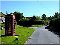
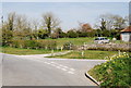
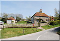
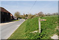

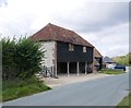
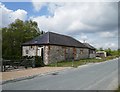
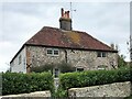
68 photos from this area
Area Information
Key information about the BN26 5RW including its size, population, and administrative classification.
- Area Type
- Postcode
- Area Size
- 33.3 hectares
- Population
- 2215
- Population Density
- 52 people/km²
House Prices in BN26 5RW
15
Properties
£693,125
Average Sold Price
£350,000
Lowest Price
£1,350,000
Highest Price
Showing 15 properties
| Address | Type | Beds | Baths | Last Sale Price | Last Sale Date | |
|---|---|---|---|---|---|---|
| New Cottage, Milton Street, Polegate, BN26 5RW | house | 3 | - | £600,000 | Jul 2020 | |
| Still Meadow, Milton Street, Polegate, BN26 5RW | Detached | 3 | 2 | £750,000 | Jun 2020 | |
| Flint Barn, Milton Street, Polegate, BN26 5RW | house | - | - | £1,350,000 | Apr 2018 | |
| Milton Street Barn, Milton Street, Polegate, BN26 5RW | Detached | 4 | 4 | £835,000 | Jun 2015 | |
| Downlands, Milton Street, Polegate, BN26 5RW | house | 3 | - | £630,000 | Feb 2011 | |
| Horseman Cottage, Milton Street, Polegate, BN26 5RW | Detached | - | - | £380,000 | Jun 2005 | |
| Little Paddocks, Milton Street, Polegate, BN26 5RW | Detached | 5 | 3 | £650,000 | Nov 2004 | |
| Long Acre, Milton Street, Polegate, BN26 5RW | Detached | - | - | £350,000 | Oct 2002 | |
| The Byre, Milton Street, Polegate, BN26 5RW | Detached | 2 | 1 | - | - | |
| Flat 1, Milton Street Farm, Milton Street, Polegate, BN26 5RW | Land | - | - | - | - |
Page 1 of 2
Energy Efficiency in BN26 5RW
Amenities
Schools
| Rank | School | Type | Entry gender | Ages |
|---|
Explore more schools in this area
Go to Schools tabDemographics
Household Size
Two person
most common
Accommodation Type
Houses
most common
Tenure
84
majority
Ethnic Group
White
most common
Religion
N/A
most common
Household Composition
N/A
most common
Age
47
median
Elderly (65+ years)
most common
Household Deprivation
N/A
with no deprivation
NS-SEC
50
in Lower managerial occupations
Explore more demographic insights in this area
Go to Demographics tabPlanning
Planning Constraints
- Flood RiskPremium
- Ramsar Wetland SitesPremium
- Area of Outstanding Natural BeautyPremium
- Protected Nature ReservePremium
- Protected WoodlandPremium