Area Overview for BN25 2LT
Photos of BN25 2LT
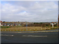
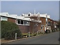

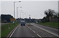
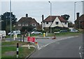
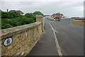
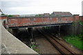
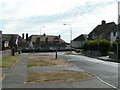
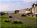

99 photos from this area
Area Information
Key information about the BN25 2LT including its size, population, and administrative classification.
- Area Type
- Postcode
- Area Size
- 1.8 hectares
- Population
- 1572
- Population Density
- 3324 people/km²
House Prices in BN25 2LT
16
Properties
£330,132
Average Sold Price
£112,000
Lowest Price
£795,000
Highest Price
Showing 16 properties
| Address | Type | Beds | Baths | Last Sale Price | Last Sale Date | |
|---|---|---|---|---|---|---|
| 27 Beacon Road, Seaford, BN25 2LT | Detached | 3 | 1 | £735,000 | Nov 2022 | |
| 34 Beacon Road, Seaford, BN25 2LT | house | - | - | £795,000 | Jan 2022 | |
| 28 Beacon Road, Seaford, BN25 2LT | house | 4 | - | £399,950 | Aug 2011 | |
| 31 Beacon Road, Seaford, BN25 2LT | Bungalow | - | - | £275,000 | Apr 2010 | |
| 39 Beacon Road, Seaford, BN25 2LT | Detached | - | - | £327,000 | Jul 2008 | |
| 38 Beacon Road, Seaford, BN25 2LT | Detached | - | - | £290,000 | Nov 2005 | |
| 33 Beacon Road, Seaford, BN25 2LT | Detached | - | - | £220,000 | Jul 2001 | |
| 32 Beacon Road, Seaford, BN25 2LT | house | - | - | £216,500 | May 2001 | |
| 25 Beacon Road, Seaford, BN25 2LT | Detached | - | - | £125,000 | Aug 1996 | |
| 37 Beacon Road, Seaford, BN25 2LT | Detached | - | - | £136,000 | Nov 1995 |
Page 1 of 2
Energy Efficiency in BN25 2LT
Amenities
Schools
| Rank | School | Type | Entry gender | Ages |
|---|
Explore more schools in this area
Go to Schools tabDemographics
Household Size
Two person
most common
Accommodation Type
Houses
most common
Tenure
81
majority
Ethnic Group
White
most common
Religion
N/A
most common
Household Composition
N/A
most common
Age
47
median
Elderly (65+ years)
most common
Household Deprivation
N/A
with no deprivation
NS-SEC
37
in Lower managerial occupations
Explore more demographic insights in this area
Go to Demographics tabPlanning
Planning Constraints
- Flood RiskPremium
- Ramsar Wetland SitesPremium
- Area of Outstanding Natural BeautyPremium
- Protected Nature ReservePremium
- Protected WoodlandPremium