Area Overview for BN25 1UA
Photos of BN25 1UA
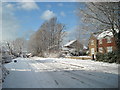
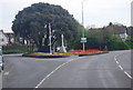
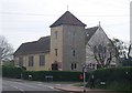
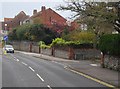
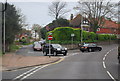
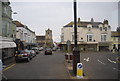
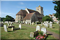
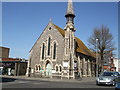
100 photos from this area
Area Information
Key information about the BN25 1UA including its size, population, and administrative classification.
- Area Type
- Postcode
- Area Size
- 1.6 hectares
- Population
- Not available
- Population Density
- Not available
House Prices in BN25 1UA
35
Properties
£229,997
Average Sold Price
£40,475
Lowest Price
£399,950
Highest Price
Showing 35 properties
| Address | Type | Beds | Baths | Last Sale Price | Last Sale Date | |
|---|---|---|---|---|---|---|
| 66 Stafford Road, Seaford, BN25 1UA | house | - | - | £399,950 | Jul 2022 | |
| 85 Stafford Road, Seaford, BN25 1UA | house | - | - | £379,000 | Mar 2022 | |
| 62 Stafford Road, Seaford, BN25 1UA | house | - | - | £375,000 | Feb 2022 | |
| 73 Stafford Road, Seaford, BN25 1UA | Retail | 3 | 2 | £395,000 | Jan 2022 | |
| 86 Stafford Road, Seaford, BN25 1UA | Semi-detached | 3 | 1 | £380,000 | Dec 2018 | |
| 87 Stafford Road, Seaford, BN25 1UA | Semi-detached | - | - | £300,000 | Oct 2018 | |
| 70 Stafford Road, Seaford, BN25 1UA | house | 3 | 1 | £315,000 | Jul 2018 | |
| 82 Stafford Road, Seaford, BN25 1UA | Semi-detached | 3 | 1 | £290,000 | Apr 2018 | |
| 68 Stafford Road, Seaford, BN25 1UA | house | - | - | £292,500 | Nov 2017 | |
| 76 Stafford Road, Seaford, BN25 1UA | Semi-detached | 3 | 2 | £295,000 | May 2015 |
Page 1 of 4
Energy Efficiency in BN25 1UA
Amenities
Schools
| Rank | School | Type | Entry gender | Ages |
|---|
Explore more schools in this area
Go to Schools tabDemographics
Household Size
One person
most common
Accommodation Type
Houses
most common
Tenure
67
majority
Ethnic Group
White
most common
Religion
N/A
most common
Household Composition
N/A
most common
Age
47
median
Adults (30-64 years)
most common
Household Deprivation
N/A
with no deprivation
NS-SEC
34
in Lower managerial occupations
Explore more demographic insights in this area
Go to Demographics tabPlanning
Planning Constraints
- Flood RiskPremium
- Ramsar Wetland SitesPremium
- Area of Outstanding Natural BeautyPremium
- Protected Nature ReservePremium
- Protected WoodlandPremium