Area Overview for BN23 8WA
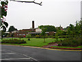
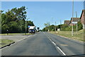
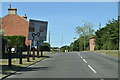
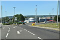
Photos of BN23 8WA
Area Information
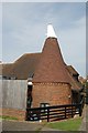
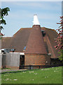
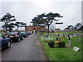
BN23 8WA is a small residential postcode in East Sussex, nestled within the Greater Eastbourne conurbation. It forms part of the village of Westham, a historic settlement with roots in the Domesday Book and proximity to Pevensey Castle. The area’s population of 2,384 is concentrated in a compact cluster, with a density of 1,473 people per square kilometre. This reflects a tight-knit community characterised by a mix of older and newer housing stock. Westham itself, with its three settlements—Westham, Stone Cross, and Hankham—offers a blend of rural charm and suburban convenience. Residents benefit from proximity to Eastbourne, just five miles away, which provides access to cultural amenities, healthcare, and employment opportunities. The area’s history is evident in landmarks like St Mary’s Church, an 11th-century Norman structure linked to early medieval settlements. While the postcode covers a small geographical footprint, its location along the Pevensey Levels—a former coastal inlet—adds a unique geographical context. Living here means balancing a quiet, historic village vibe with connections to a larger urban hub.
- Area Type
- Postcode
- Area Size
- Not available
- Population
- 2384
- Population Density
- 1473 people/km²
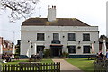
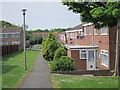
The property market in BN23 8WA is characterised by a high rate of home ownership—87%—and a focus on houses rather than flats or apartments. This suggests a predominantly owner-occupied market, with properties likely to be family homes or long-term investments. The small postcode area’s limited size means the housing stock is concentrated, though the surrounding Greater Eastbourne conurbation may offer more options for buyers seeking alternative properties. The prevalence of houses indicates a preference for private, detached living, which aligns with the area’s rural-suburban setting. For buyers, this means a market with fewer rental properties and a focus on individual ownership. However, the compact nature of BN23 8WA may limit immediate availability, requiring consideration of nearby postcodes or the broader Eastbourne region for more choices.
House Prices in BN23 8WA
No properties found in this postcode.
Energy Efficiency in BN23 8WA
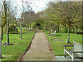
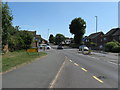
Living in BN23 8WA offers access to a range of local amenities within practical reach. Retail options include Co-op Shinewater, Iceland Eastbourne, and Tesco Eastbourne Langney, providing convenience for grocery shopping and daily essentials. The area’s rail network, with stations like Pevensey & Westham and Hampden Park, connects residents to Eastbourne’s cultural and commercial hubs, including dining, leisure, and healthcare facilities. While specific parks or recreational spaces are not detailed in the data, the proximity to Pevensey Castle and the historical significance of St Mary’s Church suggest opportunities for walking, heritage tourism, and community events. The small postcode’s compact nature means that residents can access these amenities without long commutes, fostering a lifestyle that balances local convenience with regional connectivity.
Amenities
Schools
| Rank | School | Type | Entry gender | Ages |
|---|
Explore more schools in this area
Go to Schools tabDemographics
The demographic profile of BN23 8WA is defined by a median age of 47, with the majority of residents falling into the 30–64 age range. This suggests a community skewed towards middle-aged and older adults, likely with established careers and families. Home ownership is high at 87%, indicating a stable, long-term resident base. The predominant accommodation type is houses, reflecting a preference for standalone properties over flats. The predominant ethnic group is White, though specific data on diversity or minority representation is not provided. The absence of detailed deprivation metrics means no direct commentary on socioeconomic challenges, but the high home ownership rate and age distribution imply a relatively settled population with lower turnover. This demographic structure supports a community-oriented environment, where local amenities and historical ties to the area are likely to hold significance for residents.
Household Size
Accommodation Type
Tenure
Ethnic Group
Religion
Household Composition
Age
Household Deprivation
NS-SEC
Explore more demographic insights in this area
Go to Demographics tabPlanning
Planning Constraints
- Flood RiskPremium
- Ramsar Wetland SitesPremium
- Area of Outstanding Natural BeautyPremium
- Protected Nature ReservePremium
- Protected WoodlandPremium