Area Overview for BN23 7TG
Photos of BN23 7TG
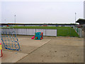
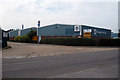
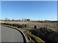
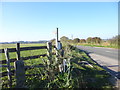
15 photos from this area
Area Information
Key information about the BN23 7TG including its size, population, and administrative classification.
- Area Type
- Postcode
- Area Size
- 1.3 hectares
- Population
- 1473
- Population Density
- 3737 people/km²
House Prices in BN23 7TG
32
Properties
£155,170
Average Sold Price
£39,950
Lowest Price
£269,950
Highest Price
Showing 32 properties
| Address | Type | Beds | Baths | Last Sale Price | Last Sale Date | |
|---|---|---|---|---|---|---|
| 16 Dickens Way, Eastbourne, BN23 7TG | Flat | - | - | £112,000 | Jan 2023 | |
| Chuzzlewit, 11 Dickens Way, Eastbourne, BN23 7TG | Semi-detached | 3 | 1 | £255,000 | Oct 2019 | |
| 12 Dickens Way, Eastbourne, BN23 7TG | Maisonette | 2 | 1 | £165,000 | May 2019 | |
| 15 Dickens Way, Eastbourne, BN23 7TG | Semi-detached | 3 | 1 | £225,000 | Apr 2019 | |
| 18 Dickens Way, Eastbourne, BN23 7TG | Flat | 2 | 1 | £168,000 | Nov 2018 | |
| 5 Dickens Way, Eastbourne, BN23 7TG | Semi-detached | 3 | 1 | £240,000 | Oct 2018 | |
| Berachah, 10 Dickens Way, Eastbourne, BN23 7TG | Flat | 2 | 1 | £175,000 | Jun 2018 | |
| 28 Dickens Way, Eastbourne, BN23 7TG | Bungalow | 2 | 1 | £269,950 | Feb 2018 | |
| 36 Dickens Way, Eastbourne, BN23 7TG | Bungalow | - | - | £247,000 | Mar 2017 | |
| 8 Dickens Way, Eastbourne, BN23 7TG | Flat | - | - | £140,000 | Jan 2017 |
Page 1 of 4
Energy Efficiency in BN23 7TG
Amenities
Schools
| Rank | School | Type | Entry gender | Ages |
|---|
Explore more schools in this area
Go to Schools tabDemographics
Household Size
Two person
most common
Accommodation Type
Houses
most common
Tenure
76
majority
Ethnic Group
White
most common
Religion
N/A
most common
Household Composition
N/A
most common
Age
47
median
Adults (30-64 years)
most common
Household Deprivation
N/A
with no deprivation
NS-SEC
33
in Lower managerial occupations
Explore more demographic insights in this area
Go to Demographics tabPlanning
Planning Constraints
- Flood RiskPremium
- Ramsar Wetland SitesPremium
- Area of Outstanding Natural BeautyPremium
- Protected Nature ReservePremium
- Protected WoodlandPremium