Area Overview for BN23 7ET
Photos of BN23 7ET
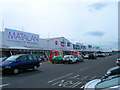
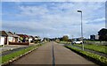
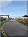
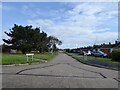
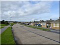
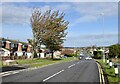
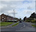
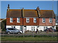
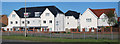
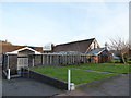
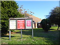
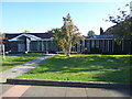
41 photos from this area
Area Information
Key information about the BN23 7ET including its size, population, and administrative classification.
- Area Type
- Postcode
- Area Size
- 8486 m²
- Population
- 1626
- Population Density
- 4920 people/km²
House Prices in BN23 7ET
32
Properties
£170,213
Average Sold Price
£32,000
Lowest Price
£268,000
Highest Price
Showing 32 properties
| Address | Type | Beds | Baths | Last Sale Price | Last Sale Date | |
|---|---|---|---|---|---|---|
| 65 Ashgate Road, Eastbourne, BN23 7ET | Terraced | 2 | 1 | £268,000 | Mar 2024 | |
| 95 Ashgate Road, Eastbourne, BN23 7ET | Terraced | 2 | 1 | £190,000 | Jan 2024 | |
| 49 Ashgate Road, Eastbourne, BN23 7ET | Retail | 2 | 1 | £255,000 | Oct 2022 | |
| 85 Ashgate Road, Eastbourne, BN23 7ET | Terraced | 3 | 1 | £250,000 | Jun 2021 | |
| 57 Ashgate Road, Eastbourne, BN23 7ET | house | - | - | £200,000 | Dec 2020 | |
| 45 Ashgate Road, Eastbourne, BN23 7ET | house | - | - | £195,000 | Sep 2020 | |
| 83 Ashgate Road, Eastbourne, BN23 7ET | Terraced | 3 | 1 | £210,000 | Nov 2019 | |
| 41 Ashgate Road, Eastbourne, BN23 7ET | Terraced | 2 | 1 | £203,000 | Jul 2017 | |
| 71 Ashgate Road, Eastbourne, BN23 7ET | Terraced | 2 | 1 | £189,950 | Oct 2015 | |
| 39 Ashgate Road, Eastbourne, BN23 7ET | Terraced | 2 | 1 | £174,950 | Aug 2015 |
Page 1 of 4
Energy Efficiency in BN23 7ET
Amenities
Schools
| Rank | School | Type | Entry gender | Ages |
|---|
Explore more schools in this area
Go to Schools tabDemographics
Household Size
Family (3-5 people)
most common
Accommodation Type
Houses
most common
Tenure
54
majority
Ethnic Group
White
most common
Religion
N/A
most common
Household Composition
N/A
most common
Age
47
median
Adults (30-64 years)
most common
Household Deprivation
N/A
with no deprivation
NS-SEC
22
in Lower managerial occupations
Explore more demographic insights in this area
Go to Demographics tabPlanning
Planning Constraints
- Flood RiskPremium
- Ramsar Wetland SitesPremium
- Area of Outstanding Natural BeautyPremium
- Protected Nature ReservePremium
- Protected WoodlandPremium