Area Overview for BN23 7BD
Photos of BN23 7BD
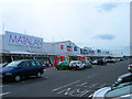
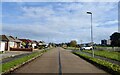
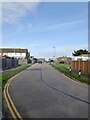
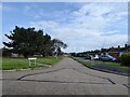
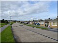
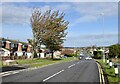
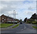
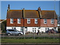
41 photos from this area
Area Information
Key information about the BN23 7BD including its size, population, and administrative classification.
- Area Type
- Postcode
- Area Size
- 4340 m²
- Population
- Not available
- Population Density
- Not available
House Prices in BN23 7BD
18
Properties
£210,869
Average Sold Price
£69,950
Lowest Price
£297,500
Highest Price
Showing 18 properties
| Address | Type | Beds | Baths | Last Sale Price | Last Sale Date | |
|---|---|---|---|---|---|---|
| 35 Priory Road, Eastbourne, BN23 7BD | Terraced | 2 | 1 | £265,000 | Jul 2024 | |
| 29 Priory Road, Eastbourne, BN23 7BD | Retail | 2 | 1 | £269,000 | Nov 2022 | |
| 21 Priory Road, Eastbourne, BN23 7BD | house | - | - | £297,500 | Aug 2022 | |
| 72 Priory Road, Eastbourne, BN23 7BD | house | - | - | £267,500 | Nov 2020 | |
| 25 Priory Road, Eastbourne, BN23 7BD | Terraced | 3 | 1 | £200,000 | Oct 2017 | |
| 33 Priory Road, Eastbourne, BN23 7BD | Terraced | 3 | 1 | £225,000 | Sep 2016 | |
| 23 Priory Road, Eastbourne, BN23 7BD | Terraced | - | - | £93,000 | Nov 2002 | |
| 66 Priory Road, Eastbourne, BN23 7BD | Terraced | - | - | £69,950 | Aug 2001 | |
| The Shambles, 27 Priory Road, Eastbourne, BN23 7BD | house | - | - | - | - | |
| 62 Priory Road, Eastbourne, BN23 7BD | Terraced | - | - | - | - |
Page 1 of 2
Energy Efficiency in BN23 7BD
Amenities
Schools
| Rank | School | Type | Entry gender | Ages |
|---|
Explore more schools in this area
Go to Schools tabDemographics
Household Size
Family (3-5 people)
most common
Accommodation Type
Houses
most common
Tenure
67
majority
Ethnic Group
White
most common
Religion
N/A
most common
Household Composition
N/A
most common
Age
47
median
Adults (30-64 years)
most common
Household Deprivation
N/A
with no deprivation
NS-SEC
23
in Lower managerial occupations
Explore more demographic insights in this area
Go to Demographics tabPlanning
Planning Constraints
- Flood RiskPremium
- Ramsar Wetland SitesPremium
- Area of Outstanding Natural BeautyPremium
- Protected Nature ReservePremium
- Protected WoodlandPremium