Area Overview for BN23 7AW
Photos of BN23 7AW
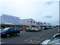
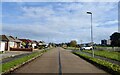
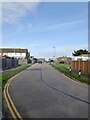
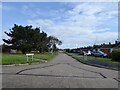
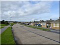
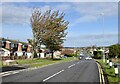
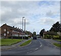
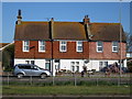
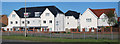
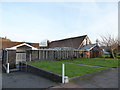
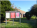
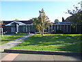
41 photos from this area
Area Information
Key information about the BN23 7AW including its size, population, and administrative classification.
- Area Type
- Postcode
- Area Size
- 2.1 hectares
- Population
- 1604
- Population Density
- 1792 people/km²
House Prices in BN23 7AW
50
Properties
£228,951
Average Sold Price
£66,000
Lowest Price
£360,000
Highest Price
Showing 50 properties
| Address | Type | Beds | Baths | Last Sale Price | Last Sale Date | |
|---|---|---|---|---|---|---|
| 16 Golding Road, Eastbourne, BN23 7AW | Bungalow | 2 | 1 | £357,500 | Nov 2025 | |
| 5 Golding Road, Eastbourne, BN23 7AW | Bungalow | 2 | 1 | £360,000 | Jan 2025 | |
| 29 Golding Road, Eastbourne, BN23 7AW | Bungalow | 2 | 1 | £340,000 | Dec 2024 | |
| The Hacienda, 2 Golding Road, Eastbourne, BN23 7AW | Bungalow | 3 | 1 | £305,000 | May 2024 | |
| Dolmac, 31 Golding Road, Eastbourne, BN23 7AW | Bungalow | 2 | 1 | £285,000 | Mar 2024 | |
| 10 Golding Road, Eastbourne, BN23 7AW | Bungalow | 2 | 1 | £325,000 | Feb 2024 | |
| 8 Golding Road, Eastbourne, BN23 7AW | Bungalow | 2 | 1 | £355,000 | Oct 2022 | |
| 36 Golding Road, Eastbourne, BN23 7AW | Bungalow | - | - | £277,000 | Mar 2021 | |
| 22 Golding Road, Eastbourne, BN23 7AW | Bungalow | - | - | £260,000 | Jan 2021 | |
| 1 Golding Road, Eastbourne, BN23 7AW | Bungalow | 3 | 1 | £300,000 | Dec 2020 |
Page 1 of 5
Energy Efficiency in BN23 7AW
Amenities
Schools
| Rank | School | Type | Entry gender | Ages |
|---|
Explore more schools in this area
Go to Schools tabDemographics
Household Size
Two person
most common
Accommodation Type
Houses
most common
Tenure
86
majority
Ethnic Group
White
most common
Religion
N/A
most common
Household Composition
N/A
most common
Age
47
median
Elderly (65+ years)
most common
Household Deprivation
N/A
with no deprivation
NS-SEC
23
in Lower managerial occupations
Explore more demographic insights in this area
Go to Demographics tabPlanning
Planning Constraints
- Flood RiskPremium
- Ramsar Wetland SitesPremium
- Area of Outstanding Natural BeautyPremium
- Protected Nature ReservePremium
- Protected WoodlandPremium