Area Overview for BN23 6BY
Photos of BN23 6BY

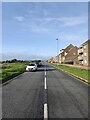
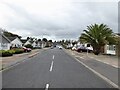
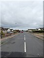
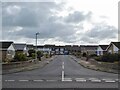
100 photos from this area
Area Information
Key information about the BN23 6BY including its size, population, and administrative classification.
- Area Type
- Postcode
- Area Size
- 8546 m²
- Population
- Not available
- Population Density
- Not available
House Prices in BN23 6BY
23
Properties
£236,303
Average Sold Price
£86,000
Lowest Price
£475,000
Highest Price
Showing 23 properties
| Address | Type | Beds | Baths | Last Sale Price | Last Sale Date | |
|---|---|---|---|---|---|---|
| 55 Mountbatten Drive, Eastbourne, BN23 6BY | Semi-detached | 4 | 1 | £420,000 | Sep 2023 | |
| The Chimes, 48 Mountbatten Drive, Eastbourne, BN23 6BY | Semi-detached | 3 | 1 | £379,000 | Aug 2023 | |
| 47 Mountbatten Drive, Eastbourne, BN23 6BY | Bungalow | 2 | 1 | £320,000 | Jan 2023 | |
| 43 Mountbatten Drive, Eastbourne, BN23 6BY | Bungalow | - | - | £325,000 | Sep 2021 | |
| 40 Mountbatten Drive, Eastbourne, BN23 6BY | house | - | - | £475,000 | Mar 2021 | |
| 57 Mountbatten Drive, Eastbourne, BN23 6BY | Detached | 3 | 1 | £330,000 | Aug 2018 | |
| 41 Mountbatten Drive, Eastbourne, BN23 6BY | Bungalow | - | - | £229,500 | Nov 2015 | |
| 49 Mountbatten Drive, Eastbourne, BN23 6BY | Detached | - | - | £280,000 | Dec 2013 | |
| 51 Mountbatten Drive, Eastbourne, BN23 6BY | Terraced | 4 | - | £265,000 | Jun 2013 | |
| 53 Mountbatten Drive, Eastbourne, BN23 6BY | Terraced | 4 | 1 | £230,000 | May 2008 |
Page 1 of 3
Energy Efficiency in BN23 6BY
Amenities
Schools
| Rank | School | Type | Entry gender | Ages |
|---|
Explore more schools in this area
Go to Schools tabDemographics
Household Size
Two person
most common
Accommodation Type
Houses
most common
Tenure
71
majority
Ethnic Group
White
most common
Religion
N/A
most common
Household Composition
N/A
most common
Age
47
median
Adults (30-64 years)
most common
Household Deprivation
N/A
with no deprivation
NS-SEC
34
in Lower managerial occupations
Explore more demographic insights in this area
Go to Demographics tabPlanning
Planning Constraints
- Flood RiskPremium
- Ramsar Wetland SitesPremium
- Area of Outstanding Natural BeautyPremium
- Protected Nature ReservePremium
- Protected WoodlandPremium