Area Overview for BN23 5UQ
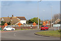
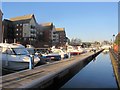
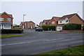
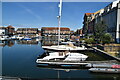
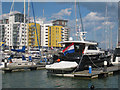
Photos of BN23 5UQ


Area Information
Living in BN23 5UQ places you within the Sovereign Ward, an electoral area in East Sussex that encompasses the Sovereign Harbour residential marina. This specific postcode covers a small residential cluster of 3,753 square metres. The site itself was formerly The Crumbles shingle beachland, which was used for gravel extraction from 1931 until 1986. The land created pits that were later flooded and adapted into the marina complex. Development planning began in the early 1970s on land gifted from private and Ministry of Defence ownership. Commercial trading started in 1993 with the opening of five interconnected artificial harbours. Residential expansion continued into the 2000s under oversight from developers including Carillion. Today, the Sovereign Harbour area contains over 3,500 homes and features a mix of permanent and holiday properties. The community atmosphere focuses on leisure and waterside living, supported by local shops, restaurants, and boating facilities. You are situated on the boardwalk edge built on former marshland and the area's surface level sits above the sea level of the outer harbour.
- Area Type
- Postcode
- Area Size
- 3753 m²
- Population
- Not available
- Population Density
- Not available
The property market in BN23 5UQ is defined by a predominance of houses within a specific marina development context. With 62 per cent of residents as homeowners, this is largely an owner-occupied area. This statistic implies that the majority of transactions involve moves between existing owner-occupiers rather than an influx of new tenants or first-time buyers entering the rental ladder. The accommodation type data confirms that houses form the primary stock, aligning with the broader description of Sovereign Harbour which contains over 3,500 homes. The distinction of living here means you are part of a planned suburban waterfront environment that caters to both permanent residents and holiday property owners. The unity of the development from 1993 to the present day creates a cohesive estate where property value is often linked to proximity to the marina and waterfront access.
House Prices in BN23 5UQ
Showing 11 properties
| Address | Type | Beds | Baths | Last Sale Price | Last Sale Date | |
|---|---|---|---|---|---|---|
| 17 Madeira Way, Eastbourne, BN23 5UQ | Semi-detached | 4 | 2 | £360,000 | Apr 2020 | |
| 3 Madeira Way, Eastbourne, BN23 5UQ | house | - | - | £309,000 | Mar 2017 | |
| 15 Madeira Way, Eastbourne, BN23 5UQ | Semi-detached | 4 | 2 | £230,000 | Jun 2012 | |
| 21 Madeira Way, Eastbourne, BN23 5UQ | Terraced | - | - | £227,000 | Feb 2010 | |
| 23 Madeira Way, Eastbourne, BN23 5UQ | house | - | - | £190,000 | Mar 2009 | |
| 11 Madeira Way, Eastbourne, BN23 5UQ | Semi-detached | - | - | £267,500 | Apr 2007 | |
| 9 Madeira Way, Eastbourne, BN23 5UQ | Semi-detached | - | - | £235,000 | May 2006 | |
| 7 Madeira Way, Eastbourne, BN23 5UQ | Semi-detached | - | - | £190,000 | Nov 2002 | |
| 19 Madeira Way, Eastbourne, BN23 5UQ | Terraced | - | - | £159,950 | Aug 2002 | |
| 5 Madeira Way, Eastbourne, BN23 5UQ | house | - | - | £155,000 | Apr 2001 |
Energy Efficiency in BN23 5UQ
Your daily lifestyle in BN23 5UQ revolves around the amenities of the Sovereign Harbour Retail Park and the marina waterfront. Retail options are plentiful, with 5 identified within practical reach. Notable supermarkets include Asda Eastbourne, The Southern Co-operative Co, and Lidl Langney. Dining and leisure are centred on the Waterfront retail and restaurant area. The Sovereign Harbour Retail Park hosts major chain stores such as Next, TK Maxx, Wilkos, and Matalan.Residents can also visit the Sovereign Harbour Yacht Club, the fishing quarter, or the 50-tonne boatyard. Historical character is a feature of the area, highlighted by Martello Tower No.66, a listed building and scheduled monument marking the entrance. The Harbour Medical Practice, opened in 2011, serves the local medical needs within the ward. The area is managed by the Sovereign Harbour Trust, which undertakes the maintenance of coastal defences and locks. This mix of modern retail, leisure, and historical structures defines the practical experience of daily living here.
Amenities
Schools
Families living in BN23 5UQ benefit from two primary educational institutions located nearby. The primary options are The Haven Voluntary Aided CofE/Methodist Primary School and The Haven Church of England Methodist Primary School. Both institutions provide primary education to children in the Sovereign Harbour community. The presence of two schools in such a small residential cluster suggests a localized educational network designed to serve the specific population density of the zone. These schools are situated within the Sovereign Ward, which also houses a general primary school to support the broader community. Access to these schools allows parents in BN23 5UQ to rely on nearby facilities without needing to commute to Eastbourne town centre for elementary education.
| Rank | School | Type | Entry gender | Ages |
|---|
Explore more schools in this area
Go to Schools tabDemographics
The community in BN23 5UQ has a population of 2,450 people living within the small footprint of the postcode area. The median age for residents is 47 years. Most inhabitants fall into the adult age range of 30 to 64 years. Housing in this cluster consists primarily of houses rather than flats or apartments. Home ownership stands at 62 per cent of the total population. The predominant ethnic group is White. These figures indicate a relatively stable, mature demographic structure. The high proportion of home ownership suggests that many residents have a long-term vested interest in the stability of the neighbourhood. The age profile points towards a family-oriented or mid-life demographic rather than a retirement community or a student population. This housing stock supports a lifestyle aligned with the established character of the Sovereign Harbour development.
Household Size
Accommodation Type
Tenure
Ethnic Group
Religion
Household Composition
Age
Household Deprivation
NS-SEC
Explore more demographic insights in this area
Go to Demographics tabPlanning
Planning Constraints
- Flood RiskPremium
- Ramsar Wetland SitesPremium
- Area of Outstanding Natural BeautyPremium
- Protected Nature ReservePremium
- Protected WoodlandPremium