Area Overview for BN22 9SF
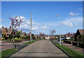
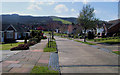
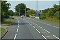
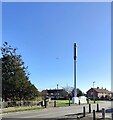
Photos of BN22 9SF
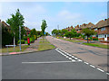
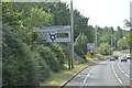
![Willingdon houses [1] in BN22 9SF](https://images.propbar.co.uk/images/geograph/71/97/7197131_120.jpg)
![Willingdon houses [2] in BN22 9SF](https://images.propbar.co.uk/images/geograph/71/97/7197134_120.jpg)
![Willingdon houses [3] in BN22 9SF](https://images.propbar.co.uk/images/geograph/71/97/7197135_120.jpg)
22 photos from this area
Area Information
Key information about the BN22 9SF including its size, population, and administrative classification.
- Area Type
- Postcode
- Area Size
- 2.5 hectares
- Population
- 1449
- Population Density
- 1950 people/km²
House Prices in BN22 9SF
39
Properties
£158,227
Average Sold Price
£43,500
Lowest Price
£272,000
Highest Price
Showing 39 properties
| Address | Type | Beds | Baths | Last Sale Price | Last Sale Date | |
|---|---|---|---|---|---|---|
| 73 Parkfield Avenue, Eastbourne, BN22 9SF | Terraced | 2 | 1 | £245,000 | Aug 2024 | |
| 55 Parkfield Avenue, Eastbourne, BN22 9SF | Semi-detached | 2 | 1 | £272,000 | Nov 2023 | |
| 67 Parkfield Avenue, Eastbourne, BN22 9SF | Semi-detached | 2 | - | £258,000 | May 2021 | |
| 68 Parkfield Avenue, Eastbourne, BN22 9SF | Semi-detached | 2 | 1 | £215,000 | Oct 2020 | |
| 51 Parkfield Avenue, Eastbourne, BN22 9SF | Terraced | 3 | 1 | £215,000 | Mar 2017 | |
| 52 Parkfield Avenue, Eastbourne, BN22 9SF | Semi-detached | 2 | 1 | £181,000 | Oct 2014 | |
| 70 Parkfield Avenue, Eastbourne, BN22 9SF | house | 3 | - | £152,000 | Nov 2011 | |
| 50 Parkfield Avenue, Eastbourne, BN22 9SF | house | - | - | £142,000 | Apr 2010 | |
| 49 Parkfield Avenue, Eastbourne, BN22 9SF | Terraced | - | - | £163,000 | Aug 2007 | |
| Calamadre, 89 Parkfield Avenue, Eastbourne, BN22 9SF | Semi-detached | - | - | £119,950 | Mar 2003 |
Page 1 of 4
Energy Efficiency in BN22 9SF
Amenities
Schools
| Rank | School | Type | Entry gender | Ages |
|---|
Explore more schools in this area
Go to Schools tabDemographics
Household Size
Two person
most common
Accommodation Type
Houses
most common
Tenure
66
majority
Ethnic Group
White
most common
Religion
N/A
most common
Household Composition
N/A
most common
Age
47
median
Adults (30-64 years)
most common
Household Deprivation
N/A
with no deprivation
NS-SEC
29
in Lower managerial occupations
Explore more demographic insights in this area
Go to Demographics tabPlanning
Planning Constraints
- Flood RiskPremium
- Ramsar Wetland SitesPremium
- Area of Outstanding Natural BeautyPremium
- Protected Nature ReservePremium
- Protected WoodlandPremium