Area Overview for BN22 9RD
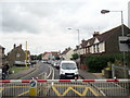
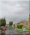
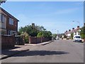
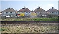
Photos of BN22 9RD
Area Information
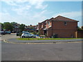
BN22 9RD is a small residential postcode area nestled within Eastbourne, East Sussex. With a population of 1,449, it reflects a tight-knit community centred around Hampden Park, a sprawling green space that defines the area’s character. The postcode covers a cluster of homes, predominantly houses, with a median age of 47 and a population skewed toward adults aged 30–64. This suggests a mature, stable demographic, likely with established families and professionals. Daily life here is shaped by proximity to Hampden Park, which offers lakes, woodland walks, and sports facilities, creating a relaxed, nature-focused lifestyle. The area’s history as part of the Ratton Estate and its 1902 opening as a public park add a layer of heritage. Residents benefit from nearby rail links, including Hampden Park Station, and a mix of retail options. BN22 9RD balances suburban tranquillity with practical connectivity, making it appealing for those seeking a quiet yet accessible location.
- Area Type
- Postcode
- Area Size
- Not available
- Population
- 1449
- Population Density
- 1950 people/km²
BN22 9RD is primarily an owner-occupied area, with 66% of homes owned by residents rather than rented. The accommodation type is houses, which aligns with the suburban character of the postcode. This suggests a market dominated by family homes, likely with gardens and private outdoor spaces. The small size of the area means property availability is limited, potentially driving competition among buyers. The high home ownership rate indicates a stable, long-term resident base, which can be reassuring for new buyers seeking a settled community. The lack of rental properties may reflect a preference for permanence, though this could also mean fewer short-term options for those entering the market. For buyers, the focus on houses implies a need for space and privacy, with the area’s proximity to green spaces and transport links adding to its appeal.
House Prices in BN22 9RD
No properties found in this postcode.
Energy Efficiency in BN22 9RD
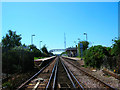
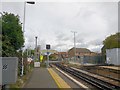
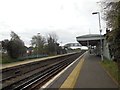
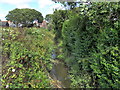
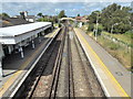
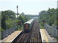
Life in BN22 9RD is shaped by its proximity to Hampden Park, a large public space with lakes, woodland, and sports facilities. The park is a focal point for leisure, offering walking trails, playgrounds, and a café. Nearby, the Southern Co-operative Co, Morrisons Daily, and Tesco Eastbourne provide retail and grocery needs. The area’s rail stations, such as Hampden Park and Eastbourne, connect residents to broader networks. St Mary’s Church, a Grade II listed building, adds historical and cultural value. The combination of green space, practical amenities, and transport links creates a balanced lifestyle. The park’s accessibility and variety of activities cater to families, outdoor enthusiasts, and those seeking relaxation. The presence of a café and free parking further enhances convenience, making daily life in BN22 9RD both enjoyable and efficient.
Amenities
Schools
BN22 9RD is served by several schools, including Parkland Junior School and Parkland Infant School, both primary institutions. Eastbourne Technology College is also listed as a primary school, which may be an anomaly but is included as per the data. The Lindfield School is a special needs institution, offering tailored education for students with specific requirements. The Eastbourne Academy, an academy school, has an Ofsted rating of inadequate, which may raise concerns for families prioritising high-quality education. The mix of school types provides options for different educational needs, from mainstream primary education to specialist support. However, the presence of an underperforming academy could affect perceptions of the area’s educational standards. Parents should consider visiting schools and reviewing Ofsted reports to assess suitability for their children.
| Rank | School | Type | Entry gender | Ages |
|---|
Explore more schools in this area
Go to Schools tabDemographics
BN22 9RD has a median age of 47, with the majority of residents falling into the 30–64 age bracket. This indicates a community of middle-aged adults, likely with long-term ties to the area. Home ownership stands at 66%, suggesting a stable housing market with a strong presence of owner-occupied properties. The accommodation type is predominantly houses, reflecting a suburban layout rather than high-density living. The predominant ethnic group is White, though no specific diversity statistics are provided. The low deprivation score, inferred from the lack of reported constraints or risks, implies a relatively affluent or well-supported population. This demographic profile supports a lifestyle focused on family living, with the area’s amenities catering to older and middle-aged residents. The absence of significant youth or elderly populations may influence local services and community dynamics.
Household Size
Accommodation Type
Tenure
Ethnic Group
Religion
Household Composition
Age
Household Deprivation
NS-SEC
Explore more demographic insights in this area
Go to Demographics tabPlanning
Planning Constraints
- Flood RiskPremium
- Ramsar Wetland SitesPremium
- Area of Outstanding Natural BeautyPremium
- Protected Nature ReservePremium
- Protected WoodlandPremium