Area Overview for BN22 8SN
Photos of BN22 8SN
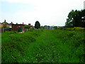
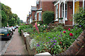

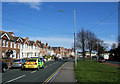
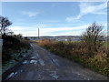
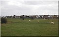
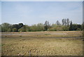
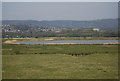
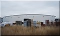
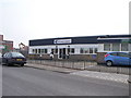
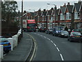
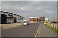
32 photos from this area
Area Information
Key information about the BN22 8SN including its size, population, and administrative classification.
- Area Type
- Postcode
- Area Size
- 1.1 hectares
- Population
- 1525
- Population Density
- 1544 people/km²
House Prices in BN22 8SN
24
Properties
£235,418
Average Sold Price
£58,000
Lowest Price
£418,000
Highest Price
Showing 24 properties
| Address | Type | Beds | Baths | Last Sale Price | Last Sale Date | |
|---|---|---|---|---|---|---|
| 5 Bowood Avenue, Eastbourne, BN22 8SN | Semi-detached | 3 | 1 | £385,000 | Mar 2025 | |
| 11 Bowood Avenue, Eastbourne, BN22 8SN | Semi-detached | 3 | 1 | £350,000 | Dec 2024 | |
| 3 Bowood Avenue, Eastbourne, BN22 8SN | Detached | 3 | 1 | £359,000 | Jun 2024 | |
| Bowood Bend, 1 Bowood Avenue, Eastbourne, BN22 8SN | Detached | 4 | 2 | £340,000 | Jun 2021 | |
| 33 Bowood Avenue, Eastbourne, BN22 8SN | house | - | - | £330,000 | Nov 2019 | |
| 14 Bowood Avenue, Eastbourne, BN22 8SN | Semi-detached | 4 | 2 | £418,000 | Dec 2017 | |
| 16 Bowood Avenue, Eastbourne, BN22 8SN | Semi-detached | 3 | 1 | £332,000 | Nov 2017 | |
| 10 Bowood Avenue, Eastbourne, BN22 8SN | Semi-detached | 4 | 2 | £265,000 | Nov 2016 | |
| 15 Bowood Avenue, Eastbourne, BN22 8SN | Semi-detached | - | - | £212,500 | Aug 2009 | |
| 20 Bowood Avenue, Eastbourne, BN22 8SN | Semi-detached | - | - | £312,500 | Apr 2008 |
Page 1 of 3
Energy Efficiency in BN22 8SN
Amenities
Schools
| Rank | School | Type | Entry gender | Ages |
|---|
Explore more schools in this area
Go to Schools tabDemographics
Household Size
Family (3-5 people)
most common
Accommodation Type
Houses
most common
Tenure
86
majority
Ethnic Group
White
most common
Religion
N/A
most common
Household Composition
N/A
most common
Age
47
median
Adults (30-64 years)
most common
Household Deprivation
N/A
with no deprivation
NS-SEC
36
in Lower managerial occupations
Explore more demographic insights in this area
Go to Demographics tabPlanning
Planning Constraints
- Flood RiskPremium
- Ramsar Wetland SitesPremium
- Area of Outstanding Natural BeautyPremium
- Protected Nature ReservePremium
- Protected WoodlandPremium