Area Overview for BN21 2WS
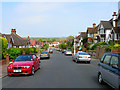
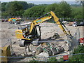
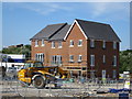
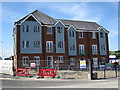
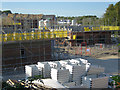
Photos of BN21 2WS
Area Information
BN21 2WS is a small, densely populated residential cluster in Eastbourne, East Sussex. With 1,994 residents spread over a compact area, it reflects the character of a town centre neighbourhood with a mix of housing types. The area is part of the Upperton district, known for its modern residential developments like The Upperton, a building offering studio, one- and two-bedroom apartments near Eastbourne train station. This postcode is within walking distance of Beacon shopping centre, Waitrose, and the unspoilt South Downs coastline. Its location offers easy access to the town’s amenities, including beaches and Sovereign Harbour, which is a 15-minute drive away. The population density of 1,538 people per square kilometre suggests a tightly knit community, though the area’s small size means it is more of a micro-locale than a sprawling suburb. Residents here benefit from proximity to transport links, retail hubs, and natural scenery, making it appealing for those seeking a balance between urban convenience and coastal living.
- Area Type
- Postcode
- Area Size
- Not available
- Population
- 1994
- Population Density
- 1538 people/km²
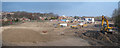
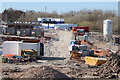
BN21 2WS is characterised by a mix of housing stock, though the official data lists the accommodation type as houses, while the area research highlights a high proportion of flats, including 58 converted units. This discrepancy suggests a blend of traditional and modern housing, with The Upperton development being a notable example of contemporary residential architecture. With 70% of homes owner-occupied, the area leans towards a stable market with long-term residents, though 56% of households are privately rented, indicating a strong rental sector. The presence of converted flats may appeal to buyers seeking smaller, manageable properties in a town centre location. However, the small size of the postcode area means the housing stock is limited, and buyers may need to look beyond BN21 2WS for more options. The proximity to Eastbourne train station and retail hubs adds to the area’s appeal, though the density of housing units suggests competition for available properties.
House Prices in BN21 2WS
No properties found in this postcode.
Energy Efficiency in BN21 2WS
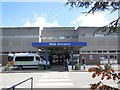
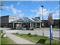
Living in BN21 2WS offers access to a range of amenities within practical reach. Retail options include Co-op Framfield, Morrisons Daily, and Waitrose Eastbourne, providing convenience for grocery shopping. The area’s proximity to Beacon shopping centre and the town’s coastal attractions means residents can enjoy both urban and natural environments. The Upperton development itself is a focal point, with its modern apartments situated near the train station and major retail hubs. The nearby South Downs offer walking and cycling opportunities, while the beaches provide leisure and recreation. This mix of retail, transport, and natural spaces contributes to a lifestyle that balances convenience with access to the outdoors.
Amenities
Schools
The nearest school to BN21 2WS is St Thomas A Becket Catholic Junior School, a primary school serving the local community. While no Ofsted rating is provided in the data, its presence indicates that families with young children have access to a primary education option within the area. The absence of secondary schools in the immediate vicinity may mean that students require transport to nearby districts for higher education. This school’s location near the town centre could be convenient for parents, though the lack of additional educational institutions suggests that families may need to consider broader catchment areas for comprehensive schooling.
| Rank | School | Type | Entry gender | Ages |
|---|
Explore more schools in this area
Go to Schools tabDemographics
The population of BN21 2WS has a median age of 47, with the majority of residents aged between 30 and 64. This suggests a community skewed towards middle-aged adults, many of whom are likely in their peak working years. Home ownership stands at 70%, higher than the national average, indicating a stable, long-term resident base. The accommodation type is predominantly houses, though the area research notes a significant presence of flats, with 80 of 102 housing units being flats, including 58 converted ones. This mix suggests a blend of owner-occupied properties and rental stock, though 56% of households are privately rented, above the national average. The predominant ethnic group is White, with no specific data on other demographics provided. The area’s occupational profile includes professionals, managers, and elementary workers, reflecting a diverse workforce. Educational attainment is high, with 64 residents holding degrees or equivalents, and health outcomes are strong, with 74% reporting very good health. These factors contribute to a community that is both economically active and socially cohesive.
Household Size
Accommodation Type
Tenure
Ethnic Group
Religion
Household Composition
Age
Household Deprivation
NS-SEC
Explore more demographic insights in this area
Go to Demographics tabPlanning
Planning Constraints
- Flood RiskPremium
- Ramsar Wetland SitesPremium
- Area of Outstanding Natural BeautyPremium
- Protected Nature ReservePremium
- Protected WoodlandPremium