Area Overview for BN21 1UU
Photos of BN21 1UU
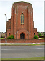
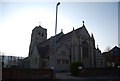
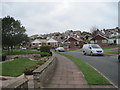
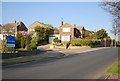
93 photos from this area
Area Information
Key information about the BN21 1UU including its size, population, and administrative classification.
- Area Type
- Postcode
- Area Size
- 2.2 hectares
- Population
- 1624
- Population Density
- 3281 people/km²
House Prices in BN21 1UU
26
Properties
£342,713
Average Sold Price
£79,950
Lowest Price
£540,000
Highest Price
Showing 26 properties
| Address | Type | Beds | Baths | Last Sale Price | Last Sale Date | |
|---|---|---|---|---|---|---|
| 30 Glendale Avenue, Eastbourne, BN21 1UU | Detached | 3 | 1 | £410,000 | Jun 2025 | |
| 18 Glendale Avenue, Eastbourne, BN21 1UU | Detached | 3 | 1 | £530,000 | Feb 2025 | |
| 24 Glendale Avenue, Eastbourne, BN21 1UU | Detached | 4 | 2 | £540,000 | Jun 2024 | |
| 8 Glendale Avenue, Eastbourne, BN21 1UU | Detached | 3 | 1 | £440,000 | Mar 2023 | |
| 44 Glendale Avenue, Eastbourne, BN21 1UU | house | - | - | £417,000 | Mar 2021 | |
| 4 Glendale Avenue, Eastbourne, BN21 1UU | house | - | - | £425,000 | Nov 2020 | |
| 52 Glendale Avenue, Eastbourne, BN21 1UU | Detached | 4 | 2 | £482,500 | Sep 2020 | |
| 12 Glendale Avenue, Eastbourne, BN21 1UU | house | - | - | £385,000 | Aug 2019 | |
| 26 Glendale Avenue, Eastbourne, BN21 1UU | Detached | 4 | 1 | £400,000 | Aug 2018 | |
| 36 Glendale Avenue, Eastbourne, BN21 1UU | Detached | 3 | 1 | £381,667 | Sep 2016 |
Page 1 of 3
Energy Efficiency in BN21 1UU
Amenities
Schools
| Rank | School | Type | Entry gender | Ages |
|---|
Explore more schools in this area
Go to Schools tabDemographics
Household Size
Family (3-5 people)
most common
Accommodation Type
Houses
most common
Tenure
83
majority
Ethnic Group
White
most common
Religion
N/A
most common
Household Composition
N/A
most common
Age
47
median
Adults (30-64 years)
most common
Household Deprivation
N/A
with no deprivation
NS-SEC
44
in Lower managerial occupations
Explore more demographic insights in this area
Go to Demographics tabPlanning
Planning Constraints
- Flood RiskPremium
- Ramsar Wetland SitesPremium
- Area of Outstanding Natural BeautyPremium
- Protected Nature ReservePremium
- Protected WoodlandPremium