Area Overview for BN21 1LH
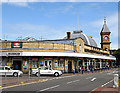
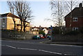
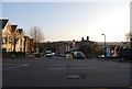
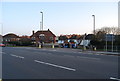
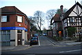
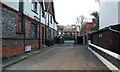
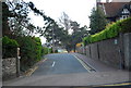
Photos of BN21 1LH

Area Information
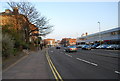
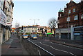
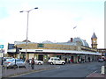
BN21 1LH lies within the urban heart of Eastbourne, East Sussex, as part of the Upperton district council ward. With a population of around 1,861, it is a compact residential cluster characterised by its proximity to key amenities and transport links. The area blends modern living with coastal accessibility, offering residents easy access to the town’s beaches, the South Downs, and Sovereign Harbour. A short walk from Eastbourne Railway Station, the postcode is well-connected to nearby towns and cities. The Upperton development itself, a prominent residential building, provides a mix of studio, one, and two-bedroom apartments, catering to those seeking town-centre convenience. Daily life here is shaped by its proximity to retail hubs like Tesco Eastbourne and Waitrose, as well as the Beacon shopping centre. The area’s mix of flats and private rentals reflects its appeal to both long-term residents and those seeking flexible housing. Its compact size ensures a tight-knit community feel, with local infrastructure meeting the needs of a population skewed toward older age groups.
- Area Type
- Postcode
- Area Size
- Not available
- Population
- Not available
- Population Density
- Not available
The property market in BN21 1LH is defined by its high concentration of flats, with 80 of 102 housing units classified as such. This contrasts with the national trend, where semi-detached and detached homes dominate. The area’s 58% home ownership rate indicates that nearly half of properties are owner-occupied, while the remaining 42% are privately rented, reflecting a rental market that supports both long-term residents and transient populations. The prevalence of converted flats suggests a mix of older buildings repurposed for modern living, often in proximity to transport hubs like Eastbourne Railway Station. For buyers, this means a focus on flats rather than traditional family homes. The compact nature of the postcode, combined with its town-centre location, makes it attractive for those prioritising convenience over space. However, the limited housing stock means competition for available properties, particularly in sought-after developments like the Upperton building.
House Prices in BN21 1LH
No properties found in this postcode.
Energy Efficiency in BN21 1LH
Living in BN21 1LH offers access to a range of amenities within walking or short driving distance. Retail options include Morrisons Daily, Tesco Eastbourne, and Waitrose Eastbourne, ensuring everyday shopping needs are met. The Beacon shopping centre provides additional retail and dining choices, while the proximity to Eastbourne’s beaches and the South Downs offers opportunities for outdoor activities. The Upperton development itself is a focal point, with its modern apartments situated near the train station and key attractions. The area’s compact size means residents can easily reach coastal walks, cafes, and cultural hubs. For families or professionals, the balance of urban convenience and natural surroundings creates a lifestyle that blends practicality with leisure. The presence of multiple rail stations further enhances accessibility, making it easy to explore the wider region.
Amenities
Schools
| Rank | School | Type | Entry gender | Ages |
|---|
Explore more schools in this area
Go to Schools tabDemographics
BN21 1LH has a median age of 47, with the elderly (65+ years) forming the most common age group. This suggests a community with a significant proportion of retired or long-established residents. Home ownership in the area stands at 58%, with flats being the predominant accommodation type. This reflects a housing stock that leans toward high-density living, with 80 of 102 housing units classified as flats, including 58 converted properties. The predominant ethnic group is White, though specific diversity figures are not detailed. The area’s 56% privately rented households exceed the national average, indicating a rental market that supports transient or younger populations. Educational attainment is high, with 64 residents holding degrees or equivalents, and health outcomes are strong, with 74% reporting very good health. These factors suggest a community that values stability and access to services, though the older demographic may influence local amenities and social dynamics.
Household Size
Accommodation Type
Tenure
Ethnic Group
Religion
Household Composition
Age
Household Deprivation
NS-SEC
Explore more demographic insights in this area
Go to Demographics tabPlanning
Planning Constraints
- Flood RiskPremium
- Ramsar Wetland SitesPremium
- Area of Outstanding Natural BeautyPremium
- Protected Nature ReservePremium
- Protected WoodlandPremium