Area Overview for BN21 1DJ
Photos of BN21 1DJ
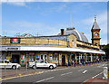

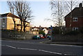
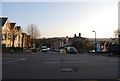
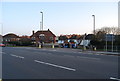
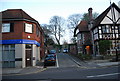
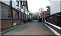
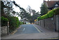
100 photos from this area
Area Information
Key information about the BN21 1DJ including its size, population, and administrative classification.
- Area Type
- Postcode
- Area Size
- 1.3 hectares
- Population
- 1951
- Population Density
- 5256 people/km²
House Prices in BN21 1DJ
42
Properties
£472,518
Average Sold Price
£19,700
Lowest Price
£1,140,000
Highest Price
Showing 42 properties
| Address | Type | Beds | Baths | Last Sale Price | Last Sale Date | |
|---|---|---|---|---|---|---|
| 16 Arlington Road, Eastbourne, BN21 1DJ | Semi-detached | 7 | 3 | £1,140,000 | Oct 2024 | |
| 18 Arlington Road, Eastbourne, BN21 1DJ | Flat | - | - | £512,500 | Aug 2023 | |
| 4 Arlington Road, Eastbourne, BN21 1DJ | house | - | - | £825,000 | Dec 2016 | |
| Sudbrook Edge, 14 Arlington Road, Eastbourne, BN21 1DJ | Semi-detached | 6 | - | £620,000 | Apr 2014 | |
| 21 Arlington Road, Eastbourne, BN21 1DJ | Flat | - | - | £19,700 | Jan 2012 | |
| 8 Arlington Road, Eastbourne, BN21 1DJ | house | - | - | £625,000 | Nov 2006 | |
| 7 Arlington Road, Eastbourne, BN21 1DJ | house | - | - | £500,000 | Sep 2005 | |
| 9 Arlington Road, Eastbourne, BN21 1DJ | house | - | - | £420,000 | Jun 2003 | |
| 3 Arlington Road, Eastbourne, BN21 1DJ | Terraced | - | - | £285,000 | May 2002 | |
| 6 Arlington Road, Eastbourne, BN21 1DJ | Semi-detached | - | - | £187,000 | Nov 1997 |
Page 1 of 5
Energy Efficiency in BN21 1DJ
Amenities
Schools
| Rank | School | Type | Entry gender | Ages |
|---|
Explore more schools in this area
Go to Schools tabDemographics
Household Size
One person
most common
Accommodation Type
Flats
most common
Tenure
44
majority
Ethnic Group
White
most common
Religion
N/A
most common
Household Composition
N/A
most common
Age
47
median
Adults (30-64 years)
most common
Household Deprivation
N/A
with no deprivation
NS-SEC
35
in Lower managerial occupations
Explore more demographic insights in this area
Go to Demographics tabPlanning
Planning Constraints
- Flood RiskPremium
- Ramsar Wetland SitesPremium
- Area of Outstanding Natural BeautyPremium
- Protected Nature ReservePremium
- Protected WoodlandPremium