Area Overview for BN20 8UL
Photos of BN20 8UL
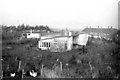
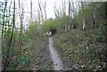
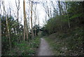
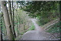
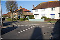
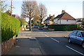
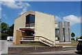
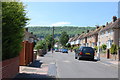
64 photos from this area
Area Information
Key information about the BN20 8UL including its size, population, and administrative classification.
- Area Type
- Postcode
- Area Size
- 1.0 hectares
- Population
- 1577
- Population Density
- 1355 people/km²
House Prices in BN20 8UL
25
Properties
£180,455
Average Sold Price
£50,000
Lowest Price
£386,000
Highest Price
Showing 25 properties
| Address | Type | Beds | Baths | Last Sale Price | Last Sale Date | |
|---|---|---|---|---|---|---|
| 101 Greenway, Eastbourne, BN20 8UL | Terraced | 2 | 1 | £270,000 | Aug 2024 | |
| 60 Greenway, Eastbourne, BN20 8UL | Terraced | 2 | 1 | £270,000 | Feb 2024 | |
| 93 Greenway, Eastbourne, BN20 8UL | Detached | 4 | 1 | £386,000 | Oct 2018 | |
| 70 Greenway, Eastbourne, BN20 8UL | Terraced | 3 | 1 | £225,000 | Apr 2016 | |
| 62 Greenway, Eastbourne, BN20 8UL | Terraced | 2 | 1 | £169,000 | May 2015 | |
| 89 Greenway, Eastbourne, BN20 8UL | Bungalow | - | - | £180,000 | Nov 2013 | |
| 103 Greenway, Eastbourne, BN20 8UL | house | - | - | £141,000 | Jan 2009 | |
| Rowlatt, 99 Greenway, Eastbourne, BN20 8UL | Terraced | - | - | £178,000 | Mar 2008 | |
| 109 Greenway, Eastbourne, BN20 8UL | Terraced | - | - | £56,000 | Apr 1999 | |
| 58 Greenway, Eastbourne, BN20 8UL | house | - | - | £50,000 | Jan 1998 |
Page 1 of 3
Energy Efficiency in BN20 8UL
Amenities
Schools
| Rank | School | Type | Entry gender | Ages |
|---|
Explore more schools in this area
Go to Schools tabDemographics
Household Size
One person
most common
Accommodation Type
Houses
most common
Tenure
62
majority
Ethnic Group
White
most common
Religion
N/A
most common
Household Composition
N/A
most common
Age
47
median
Adults (30-64 years)
most common
Household Deprivation
N/A
with no deprivation
NS-SEC
32
in Lower managerial occupations
Explore more demographic insights in this area
Go to Demographics tabPlanning
Planning Constraints
- Flood RiskPremium
- Ramsar Wetland SitesPremium
- Area of Outstanding Natural BeautyPremium
- Protected Nature ReservePremium
- Protected WoodlandPremium