Area Overview for BN20 7TZ
Photos of BN20 7TZ
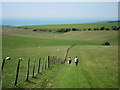
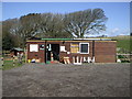

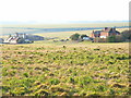
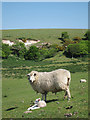
59 photos from this area
Area Information
Key information about the BN20 7TZ including its size, population, and administrative classification.
- Area Type
- Postcode
- Area Size
- 10.5 hectares
- Population
- 2250
- Population Density
- 213 people/km²
House Prices in BN20 7TZ
18
Properties
£576,227
Average Sold Price
£215,000
Lowest Price
£925,000
Highest Price
Showing 18 properties
| Address | Type | Beds | Baths | Last Sale Price | Last Sale Date | |
|---|---|---|---|---|---|---|
| Mangala, 17 Lincoln Close, Eastbourne, BN20 7TZ | Detached | 4 | 3 | £925,000 | Jun 2022 | |
| 14 Lincoln Close, Eastbourne, BN20 7TZ | house | - | - | £735,000 | Nov 2021 | |
| 23 Lincoln Close, Eastbourne, BN20 7TZ | Bungalow | 3 | 2 | £810,000 | Dec 2018 | |
| South Edge, 5 Lincoln Close, Eastbourne, BN20 7TZ | Bungalow | 3 | 2 | £600,000 | Oct 2015 | |
| Beachy Lodge, 11 Lincoln Close, Eastbourne, BN20 7TZ | Detached | 4 | 2 | £686,000 | Sep 2015 | |
| 4 Lincoln Close, Eastbourne, BN20 7TZ | Detached | 4 | 2 | £515,000 | Jul 2015 | |
| 8 Lincoln Close, Eastbourne, BN20 7TZ | Detached | 4 | 2 | £437,000 | Jul 2011 | |
| 19 Lincoln Close, Eastbourne, BN20 7TZ | Detached | - | - | £518,000 | Aug 2007 | |
| 15 Lincoln Close, Eastbourne, BN20 7TZ | Detached | 4 | 3 | £472,500 | Jun 2005 | |
| 9 Lincoln Close, Eastbourne, BN20 7TZ | Detached | - | - | £425,000 | Aug 2004 |
Page 1 of 2
Energy Efficiency in BN20 7TZ
Amenities
Schools
| Rank | School | Type | Entry gender | Ages |
|---|
Explore more schools in this area
Go to Schools tabDemographics
Household Size
Two person
most common
Accommodation Type
Flats
most common
Tenure
72
majority
Ethnic Group
White
most common
Religion
N/A
most common
Household Composition
N/A
most common
Age
47
median
Elderly (65+ years)
most common
Household Deprivation
N/A
with no deprivation
NS-SEC
50
in Lower managerial occupations
Explore more demographic insights in this area
Go to Demographics tabPlanning
Planning Constraints
- Flood RiskPremium
- Ramsar Wetland SitesPremium
- Area of Outstanding Natural BeautyPremium
- Protected Nature ReservePremium
- Protected WoodlandPremium