Area Overview for BN20 7QJ
Photos of BN20 7QJ
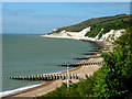

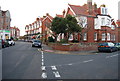
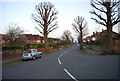
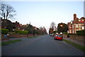

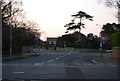
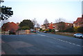
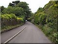
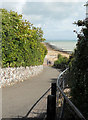
100 photos from this area
Area Information
Key information about the BN20 7QJ including its size, population, and administrative classification.
- Area Type
- Postcode
- Area Size
- 1.7 hectares
- Population
- 1694
- Population Density
- 2578 people/km²
House Prices in BN20 7QJ
24
Properties
£669,521
Average Sold Price
£290,000
Lowest Price
£1,487,691
Highest Price
Showing 24 properties
| Address | Type | Beds | Baths | Last Sale Price | Last Sale Date | |
|---|---|---|---|---|---|---|
| Springfield, 76 Meads Road, Eastbourne, BN20 7QJ | Semi-detached | 4 | 2 | £562,000 | Nov 2023 | |
| The Warren, 82 Meads Road, Eastbourne, BN20 7QJ | Detached | 5 | 3 | £1,000,000 | Jul 2023 | |
| Coachmans, 78 Meads Road, Eastbourne, BN20 7QJ | house | - | - | £443,500 | Sep 2016 | |
| Elstree Court, 64 Meads Road, Eastbourne, BN20 7QJ | hospital_care_home | - | - | £1,487,691 | Jul 2016 | |
| Meads House, 72 Meads Road, Eastbourne, BN20 7QJ | house | 4 | 3 | £785,000 | Dec 2013 | |
| The Coach House, 80 Meads Road, Eastbourne, BN20 7QJ | house | - | - | £472,500 | Jan 2010 | |
| 58 Meads Road, Eastbourne, BN20 7QJ | Detached | 3 | - | £290,000 | May 2008 | |
| Endsleigh, 62 Meads Road, Eastbourne, BN20 7QJ | Bungalow | 3 | 2 | £500,000 | May 2007 | |
| Ambrose Cottage, 70 Meads Road, Eastbourne, BN20 7QJ | Terraced | - | - | £485,000 | Jun 2001 | |
| 14, Elstree Court, 64 Meads Road, Eastbourne, BN20 7QJ | undefined | - | - | - | - |
Page 1 of 3
Energy Efficiency in BN20 7QJ
Amenities
Schools
| Rank | School | Type | Entry gender | Ages |
|---|
Explore more schools in this area
Go to Schools tabDemographics
Household Size
One person
most common
Accommodation Type
Flats
most common
Tenure
74
majority
Ethnic Group
White
most common
Religion
N/A
most common
Household Composition
N/A
most common
Age
47
median
Elderly (65+ years)
most common
Household Deprivation
N/A
with no deprivation
NS-SEC
37
in Lower managerial occupations
Explore more demographic insights in this area
Go to Demographics tabPlanning
Planning Constraints
- Flood RiskPremium
- Ramsar Wetland SitesPremium
- Area of Outstanding Natural BeautyPremium
- Protected Nature ReservePremium
- Protected WoodlandPremium