Area Overview for BN20 7EA
Photos of BN20 7EA


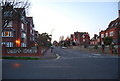
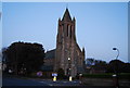
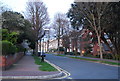
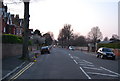
100 photos from this area
Area Information
Key information about the BN20 7EA including its size, population, and administrative classification.
- Area Type
- Postcode
- Area Size
- 2618 m²
- Population
- Not available
- Population Density
- Not available
House Prices in BN20 7EA
2
Properties
£277,000
Average Sold Price
£277,000
Lowest Price
£277,000
Highest Price
Showing 2 properties
| Address | Type | Beds | Baths | Last Sale Price | Last Sale Date | |
|---|---|---|---|---|---|---|
| The Old School House, 21 Meads Road, Eastbourne, BN20 7EA | Detached | - | - | £277,000 | Mar 2004 | |
| Meads Lodge, 23 Meads Road, Eastbourne, BN20 7EA | Retail | 3 | 3 | - | - |
Energy Efficiency in BN20 7EA
Amenities
Schools
| Rank | School | Type | Entry gender | Ages |
|---|
Explore more schools in this area
Go to Schools tabDemographics
Household Size
One person
most common
Accommodation Type
Flats
most common
Tenure
78
majority
Ethnic Group
White
most common
Religion
N/A
most common
Household Composition
N/A
most common
Age
70
median
Elderly (65+ years)
most common
Household Deprivation
N/A
with no deprivation
NS-SEC
46
in Lower managerial occupations
Explore more demographic insights in this area
Go to Demographics tabPlanning
Planning Constraints
- Flood RiskPremium
- Ramsar Wetland SitesPremium
- Area of Outstanding Natural BeautyPremium
- Protected Nature ReservePremium
- Protected WoodlandPremium