Area Overview for BN2 9ZP
Photos of BN2 9ZP
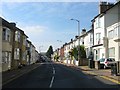
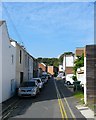
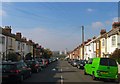
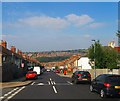
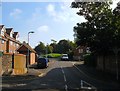
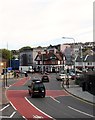
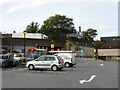
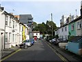
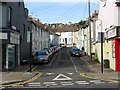
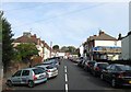
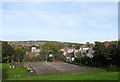
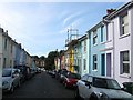
100 photos from this area
Area Information
Key information about the BN2 9ZP including its size, population, and administrative classification.
- Area Type
- Postcode
- Area Size
- 1.5 hectares
- Population
- 1632
- Population Density
- 4532 people/km²
House Prices in BN2 9ZP
59
Properties
£239,905
Average Sold Price
£47,000
Lowest Price
£445,000
Highest Price
Showing 59 properties
| Address | Type | Beds | Baths | Last Sale Price | Last Sale Date | |
|---|---|---|---|---|---|---|
| 26 Clayton Road, Brighton, BN2 9ZP | Semi-detached | 3 | 1 | £345,000 | Jun 2025 | |
| 37 Clayton Road, Brighton, BN2 9ZP | house | 3 | 2 | £432,000 | Apr 2024 | |
| 1 Clayton Road, Brighton, BN2 9ZP | Semi-detached | 3 | 1 | £375,000 | Jun 2023 | |
| 32 Clayton Road, Brighton, BN2 9ZP | house | - | - | £417,500 | Jun 2021 | |
| 12 Clayton Road, Brighton, BN2 9ZP | house | - | - | £325,000 | Nov 2020 | |
| 41 Clayton Road, Brighton, BN2 9ZP | Semi-detached | 4 | 1 | £445,000 | Mar 2020 | |
| 3 Clayton Road, Brighton, BN2 9ZP | Semi-detached | 3 | 1 | £300,500 | Mar 2020 | |
| 38 Clayton Road, Brighton, BN2 9ZP | Semi-detached | 3 | 1 | £325,000 | Nov 2018 | |
| 51 Clayton Road, Brighton, BN2 9ZP | Terraced | 2 | 1 | £315,000 | Oct 2018 | |
| 57 Clayton Road, Brighton, BN2 9ZP | house | - | - | £331,500 | Nov 2017 |
Page 1 of 6
Energy Efficiency in BN2 9ZP
Amenities
Schools
| Rank | School | Type | Entry gender | Ages |
|---|
Explore more schools in this area
Go to Schools tabDemographics
Household Size
Family (3-5 people)
most common
Accommodation Type
Houses
most common
Tenure
42
majority
Ethnic Group
White
most common
Religion
N/A
most common
Household Composition
N/A
most common
Age
47
median
Adults (30-64 years)
most common
Household Deprivation
N/A
with no deprivation
NS-SEC
27
in Lower managerial occupations
Explore more demographic insights in this area
Go to Demographics tabPlanning
Planning Constraints
- Flood RiskPremium
- Ramsar Wetland SitesPremium
- Area of Outstanding Natural BeautyPremium
- Protected Nature ReservePremium
- Protected WoodlandPremium