Area Overview for BN2 9YH
Photos of BN2 9YH
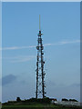
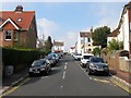
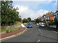
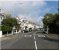
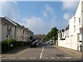
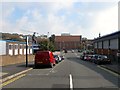
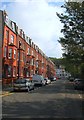
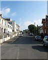
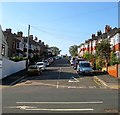
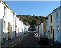
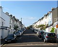
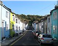
100 photos from this area
Area Information
Key information about the BN2 9YH including its size, population, and administrative classification.
- Area Type
- Postcode
- Area Size
- 1.4 hectares
- Population
- 1632
- Population Density
- 4532 people/km²
House Prices in BN2 9YH
64
Properties
£248,099
Average Sold Price
£52,000
Lowest Price
£513,500
Highest Price
Showing 64 properties
| Address | Type | Beds | Baths | Last Sale Price | Last Sale Date | |
|---|---|---|---|---|---|---|
| 1 Firle Road, Brighton, BN2 9YH | Semi-detached | 3 | 1 | £312,000 | Jun 2024 | |
| 41 Firle Road, Brighton, BN2 9YH | house | - | - | £325,000 | May 2024 | |
| 3 Firle Road, Brighton, BN2 9YH | Semi-detached | 3 | 1 | £450,000 | May 2024 | |
| 19 Firle Road, Brighton, BN2 9YH | Retail | 3 | 2 | £513,500 | Sep 2022 | |
| 25 Firle Road, Brighton, BN2 9YH | Retail | 3 | - | £351,000 | May 2022 | |
| 37 Firle Road, Brighton, BN2 9YH | Semi-detached | 3 | - | £407,000 | Dec 2021 | |
| 15 Firle Road, Brighton, BN2 9YH | Semi-detached | 2 | - | £335,580 | Jul 2020 | |
| 4 Firle Road, Brighton, BN2 9YH | Semi-detached | 3 | 1 | £302,000 | Jun 2020 | |
| 12 Firle Road, Brighton, BN2 9YH | Semi-detached | 3 | 1 | £340,000 | May 2019 | |
| 6 Firle Road, Brighton, BN2 9YH | Terraced | 3 | 1 | £315,000 | Dec 2018 |
Page 1 of 7
Energy Efficiency in BN2 9YH
Amenities
Schools
| Rank | School | Type | Entry gender | Ages |
|---|
Explore more schools in this area
Go to Schools tabDemographics
Household Size
Family (3-5 people)
most common
Accommodation Type
Houses
most common
Tenure
42
majority
Ethnic Group
White
most common
Religion
N/A
most common
Household Composition
N/A
most common
Age
47
median
Adults (30-64 years)
most common
Household Deprivation
N/A
with no deprivation
NS-SEC
27
in Lower managerial occupations
Explore more demographic insights in this area
Go to Demographics tabPlanning
Planning Constraints
- Flood RiskPremium
- Ramsar Wetland SitesPremium
- Area of Outstanding Natural BeautyPremium
- Protected Nature ReservePremium
- Protected WoodlandPremium