Area Overview for BN2 9YE
Photos of BN2 9YE
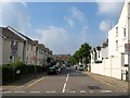
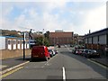
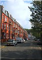
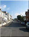
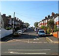
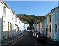
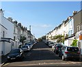
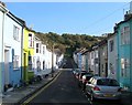
100 photos from this area
Area Information
Key information about the BN2 9YE including its size, population, and administrative classification.
- Area Type
- Postcode
- Area Size
- 1.1 hectares
- Population
- 1499
- Population Density
- 11647 people/km²
House Prices in BN2 9YE
55
Properties
£401,401
Average Sold Price
£72,000
Lowest Price
£735,000
Highest Price
Showing 55 properties
| Address | Type | Beds | Baths | Last Sale Price | Last Sale Date | |
|---|---|---|---|---|---|---|
| 193 Freshfield Road, Brighton, BN2 9YE | Terraced | 3 | 1 | £625,000 | Oct 2025 | |
| 215 Freshfield Road, Brighton, BN2 9YE | Terraced | 4 | 2 | £710,000 | Jan 2025 | |
| 135 Freshfield Road, Brighton, BN2 9YE | house | 3 | 1 | £542,000 | Dec 2023 | |
| 173 Freshfield Road, Brighton, BN2 9YE | house | - | - | £700,000 | Oct 2023 | |
| Ground Floor Flat, 173 Freshfield Road, Brighton, BN2 9YE | Flat | - | - | £137,500 | Mar 2023 | |
| 207 Freshfield Road, Brighton, BN2 9YE | house | 4 | 2 | £735,000 | Jun 2021 | |
| 189A Freshfield Road, Brighton, BN2 9YE | Maisonette | 2 | 1 | £340,000 | Mar 2021 | |
| 161 Freshfield Road, Brighton, BN2 9YE | Terraced | 3 | 1 | £575,000 | Jun 2019 | |
| 163 Freshfield Road, Brighton, BN2 9YE | house | - | - | £695,000 | Jun 2018 | |
| 165 Freshfield Road, Brighton, BN2 9YE | Semi-detached | 4 | 2 | £570,000 | Jul 2017 |
Page 1 of 6
Energy Efficiency in BN2 9YE
Amenities
Schools
| Rank | School | Type | Entry gender | Ages |
|---|
Explore more schools in this area
Go to Schools tabDemographics
Household Size
Family (3-5 people)
most common
Accommodation Type
Houses
most common
Tenure
70
majority
Ethnic Group
White
most common
Religion
N/A
most common
Household Composition
N/A
most common
Age
47
median
Adults (30-64 years)
most common
Household Deprivation
N/A
with no deprivation
NS-SEC
51
in Lower managerial occupations
Explore more demographic insights in this area
Go to Demographics tabPlanning
Planning Constraints
- Flood RiskPremium
- Ramsar Wetland SitesPremium
- Area of Outstanding Natural BeautyPremium
- Protected Nature ReservePremium
- Protected WoodlandPremium