Area Overview for BN2 9YA
Photos of BN2 9YA
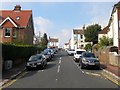
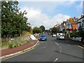
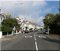
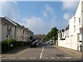
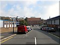
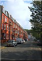
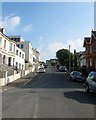
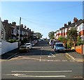
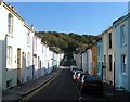
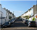
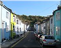
100 photos from this area
Area Information
Key information about the BN2 9YA including its size, population, and administrative classification.
- Area Type
- Postcode
- Area Size
- 9308 m²
- Population
- 1499
- Population Density
- 11647 people/km²
House Prices in BN2 9YA
38
Properties
£588,694
Average Sold Price
£159,000
Lowest Price
£795,000
Highest Price
Showing 38 properties
| Address | Type | Beds | Baths | Last Sale Price | Last Sale Date | |
|---|---|---|---|---|---|---|
| 9 Queens Park Terrace, Brighton, BN2 9YA | house | 3 | 2 | £740,000 | Oct 2025 | |
| 15 Queens Park Terrace, Brighton, BN2 9YA | Terraced | 4 | 2 | £795,000 | Nov 2023 | |
| 21 Queens Park Terrace, Brighton, BN2 9YA | Terraced | 4 | 1 | £760,000 | Feb 2022 | |
| 10 Queens Park Terrace, Brighton, BN2 9YA | house | - | - | £765,000 | Mar 2021 | |
| 17 Queens Park Terrace, Brighton, BN2 9YA | house | - | - | £627,900 | Feb 2021 | |
| 16 Queens Park Terrace, Brighton, BN2 9YA | house | - | - | £735,000 | Feb 2021 | |
| 8 Queens Park Terrace, Brighton, BN2 9YA | house | 4 | - | £735,750 | Jan 2021 | |
| 5 Queens Park Terrace, Brighton, BN2 9YA | Terraced | 5 | 2 | £637,500 | Nov 2019 | |
| 39 Queens Park Terrace, Brighton, BN2 9YA | Terraced | 3 | 2 | £570,000 | Apr 2019 | |
| 37 Queens Park Terrace, Brighton, BN2 9YA | house | - | - | £630,000 | Oct 2016 |
Page 1 of 4
Energy Efficiency in BN2 9YA
Amenities
Schools
| Rank | School | Type | Entry gender | Ages |
|---|
Explore more schools in this area
Go to Schools tabDemographics
Household Size
Family (3-5 people)
most common
Accommodation Type
Houses
most common
Tenure
70
majority
Ethnic Group
White
most common
Religion
N/A
most common
Household Composition
N/A
most common
Age
47
median
Adults (30-64 years)
most common
Household Deprivation
N/A
with no deprivation
NS-SEC
51
in Lower managerial occupations
Explore more demographic insights in this area
Go to Demographics tabPlanning
Planning Constraints
- Flood RiskPremium
- Ramsar Wetland SitesPremium
- Area of Outstanding Natural BeautyPremium
- Protected Nature ReservePremium
- Protected WoodlandPremium