Area Overview for BN2 9SS
Photos of BN2 9SS
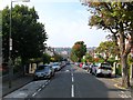
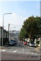
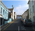
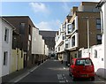
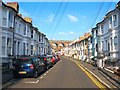
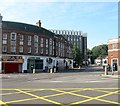
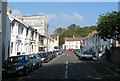
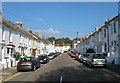
100 photos from this area
Area Information
Key information about the BN2 9SS including its size, population, and administrative classification.
- Area Type
- Postcode
- Area Size
- 6171 m²
- Population
- 1916
- Population Density
- 19641 people/km²
House Prices in BN2 9SS
68
Properties
£319,040
Average Sold Price
£40,000
Lowest Price
£608,806
Highest Price
Showing 68 properties
| Address | Type | Beds | Baths | Last Sale Price | Last Sale Date | |
|---|---|---|---|---|---|---|
| 88 Hanover Street, Brighton, BN2 9SS | Terraced | 4 | 2 | £608,806 | Dec 2025 | |
| 53 Hanover Street, Brighton, BN2 9SS | Terraced | 2 | 1 | £491,400 | Jan 2025 | |
| 84 Hanover Street, Brighton, BN2 9SS | Terraced | 3 | 2 | £520,000 | Mar 2024 | |
| 89 Hanover Street, Brighton, BN2 9SS | Terraced | 3 | 1 | £463,000 | Dec 2023 | |
| 83 Hanover Street, Brighton, BN2 9SS | Terraced | 6 | 2 | £580,000 | Dec 2023 | |
| 86B Hanover Street, Brighton, BN2 9SS | Flat | - | - | £249,000 | Oct 2023 | |
| 75 Hanover Street, Brighton, BN2 9SS | Terraced | 3 | 2 | £535,000 | Mar 2023 | |
| 56 Hanover Street, Brighton, BN2 9SS | Retail | 3 | 1 | £572,500 | Sep 2022 | |
| 58 Hanover Street, Brighton, BN2 9SS | house | - | - | £580,000 | Aug 2022 | |
| 74A Hanover Street, Brighton, BN2 9SS | Terraced | 3 | 2 | £530,000 | Apr 2022 |
Page 1 of 7
Energy Efficiency in BN2 9SS
Amenities
Schools
| Rank | School | Type | Entry gender | Ages |
|---|
Explore more schools in this area
Go to Schools tabDemographics
Household Size
Two person
most common
Accommodation Type
Houses
most common
Tenure
43
majority
Ethnic Group
White
most common
Religion
N/A
most common
Household Composition
N/A
most common
Age
22
median
Adults (30-64 years)
most common
Household Deprivation
N/A
with no deprivation
NS-SEC
35
in Lower managerial occupations
Explore more demographic insights in this area
Go to Demographics tabPlanning
Planning Constraints
- Flood RiskPremium
- Ramsar Wetland SitesPremium
- Area of Outstanding Natural BeautyPremium
- Protected Nature ReservePremium
- Protected WoodlandPremium