Area Overview for BN2 7EU
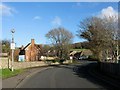
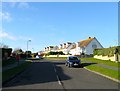
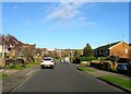
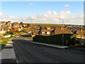
Photos of BN2 7EU
Area Information
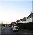
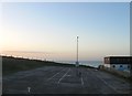
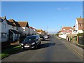
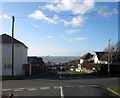
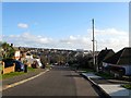
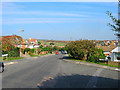
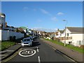
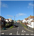
BN2 7EU lies in Rottingdean, a coastal village on Brighton and Hove’s south coast, 4 miles southeast of Brighton. With a population of 1,716 and a density of 1,192 people per square kilometre, it is a compact, residential cluster blending seaside charm with historic character. The village borders Saltdean, Ovingdean, and Woodingdean, offering a mix of coastal vistas and village life. Rottingdean’s heritage is evident in its Grade II-listed windmill, Kipling Gardens, and 19th-century terraces. Daily life here balances quiet coastal living with proximity to Brighton’s urban amenities. The area’s appeal lies in its preserved heritage, low crime rates, and strong community ties. Residents enjoy a slower pace of life, with local shops, rail links, and proximity to nature reserves. Its small size means a tight-knit community, where landmarks like the windmill and Beacon Hill are central to local identity. For buyers, BN2 7EU offers a rare blend of seaside tranquillity and historic preservation, ideal for those seeking a stable, characterful home.
- Area Type
- Postcode
- Area Size
- Not available
- Population
- 1716
- Population Density
- 1192 people/km²
BN2 7EU is predominantly an owner-occupied area, with 74% of homes owned by residents rather than rented. The accommodation type is largely houses, which is unusual for a small postcode area but reflects Rottingdean’s historic development as a residential village. This mix of older, characterful homes and limited flat stock means the property market here is niche, with fewer options for buyers compared to larger urban areas. The high home ownership rate suggests a mature market with limited turnover, potentially making it challenging for new buyers to find available properties. However, the area’s preserved heritage and low crime rates may appeal to those seeking a secure, stable investment. Buyers should consider the small size of the postcode, which may mean competition for properties and a need to look at nearby areas for more options.
House Prices in BN2 7EU
No properties found in this postcode.
Energy Efficiency in BN2 7EU
BN2 7EU offers a mix of practical amenities within reach, including five retail outlets such as Budgens Rottingdean, Tesco Rottingdean, and Co-op Saltdean. These shops provide everyday convenience, from groceries to general retail. The area’s proximity to rail stations like Moulsecoomb and Falmer enhances mobility, linking residents to Brighton’s cultural and commercial centres. Landmarks like the Grade II-listed windmill, Beacon Hill, and Kipling Gardens add to the village’s historic charm, offering recreational and scenic value. The small size of the postcode means amenities are concentrated, fostering a walkable, community-focused lifestyle. Residents benefit from a blend of coastal living, heritage sites, and accessible transport, creating a balance between tranquillity and connectivity.
Amenities
Schools
The nearest school to BN2 7EU is St Aubyn’s School, an independent institution. No other schools are listed in the data, meaning families may need to look beyond the immediate postcode for state education options. The presence of an independent school suggests the area attracts households prioritising private education, though the absence of state schools in the data implies that local schooling is not a major feature of BN2 7EU itself. Parents should investigate nearby areas for state schools, as the village’s small size may limit educational choices. The lack of detailed Ofsted ratings means prospective buyers should conduct further research into school quality and availability beyond the immediate postcode.
| Rank | School | Type | Entry gender | Ages |
|---|
Explore more schools in this area
Go to Schools tabDemographics
BN2 7EU’s population of 1,716 is predominantly middle-aged, with a median age of 47 and the most common age range being 30–64 years. This suggests a mature, stable community with fewer young families or retirees compared to other areas. Home ownership is high at 74%, indicating a strong presence of long-term residents and a market skewed toward owner-occupied properties. The area is largely composed of houses, reflecting a residential profile that favours family homes over flats. The predominant ethnic group is White, though specific diversity metrics are not detailed. The low population density of 1,192 people per square kilometre suggests spacious living conditions, with homes likely set in larger plots. This demographic profile aligns with a community prioritising stability and heritage, where property values may reflect the area’s preserved character and limited development.
Household Size
Accommodation Type
Tenure
Ethnic Group
Religion
Household Composition
Age
Household Deprivation
NS-SEC
Explore more demographic insights in this area
Go to Demographics tabPlanning
Planning Constraints
- Flood RiskPremium
- Ramsar Wetland SitesPremium
- Area of Outstanding Natural BeautyPremium
- Protected Nature ReservePremium
- Protected WoodlandPremium