Area Overview for BN2 6TL
Photos of BN2 6TL
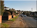
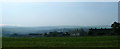
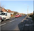
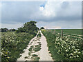
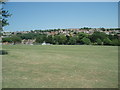
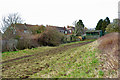
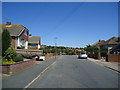
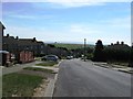
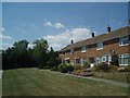
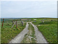
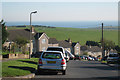
11 photos from this area
Area Information
Key information about the BN2 6TL including its size, population, and administrative classification.
- Area Type
- Postcode
- Area Size
- 9572 m²
- Population
- 1375
- Population Density
- 431 people/km²
House Prices in BN2 6TL
31
Properties
£246,214
Average Sold Price
£68,000
Lowest Price
£420,000
Highest Price
Showing 31 properties
| Address | Type | Beds | Baths | Last Sale Price | Last Sale Date | |
|---|---|---|---|---|---|---|
| 52 Foxdown Road, Brighton, BN2 6TL | Detached | 3 | 1 | £354,000 | Aug 2025 | |
| 38 Foxdown Road, Brighton, BN2 6TL | house | - | - | £318,500 | Feb 2024 | |
| 46 Foxdown Road, Brighton, BN2 6TL | Detached | 2 | 1 | £305,000 | Jan 2024 | |
| 32 Foxdown Road, Brighton, BN2 6TL | house | - | - | £420,000 | Nov 2022 | |
| 60 Foxdown Road, Brighton, BN2 6TL | house | - | - | £347,500 | Jun 2022 | |
| 54 Foxdown Road, Brighton, BN2 6TL | house | - | - | £284,000 | Jul 2021 | |
| 44 Foxdown Road, Brighton, BN2 6TL | house | - | - | £292,000 | Mar 2021 | |
| 16 Foxdown Road, Brighton, BN2 6TL | house | 3 | 1 | £267,000 | Aug 2019 | |
| 24 Foxdown Road, Brighton, BN2 6TL | Terraced | 2 | 1 | £285,000 | Dec 2017 | |
| 18 Foxdown Road, Brighton, BN2 6TL | house | - | - | £265,000 | Dec 2017 |
Page 1 of 4
Energy Efficiency in BN2 6TL
Amenities
Schools
| Rank | School | Type | Entry gender | Ages |
|---|
Explore more schools in this area
Go to Schools tabDemographics
Household Size
Family (3-5 people)
most common
Accommodation Type
Houses
most common
Tenure
46
majority
Ethnic Group
White
most common
Religion
N/A
most common
Household Composition
N/A
most common
Age
47
median
Adults (30-64 years)
most common
Household Deprivation
N/A
with no deprivation
NS-SEC
24
in Lower managerial occupations
Explore more demographic insights in this area
Go to Demographics tabPlanning
Planning Constraints
- Flood RiskPremium
- Ramsar Wetland SitesPremium
- Area of Outstanding Natural BeautyPremium
- Protected Nature ReservePremium
- Protected WoodlandPremium