Area Overview for BN2 6QR
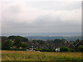
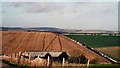
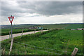
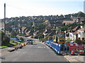
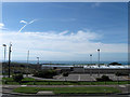
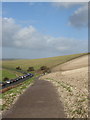
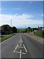
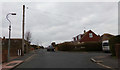
Photos of BN2 6QR

Area Information
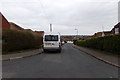
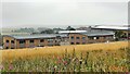
BN2 6QR lies within the eastern suburb of Woodingdean, a quiet residential cluster in Brighton and Hove, East Sussex. Separated from the city centre by the South Downs and the Brighton Racecourse, the area developed from rural farmland after the First World War, with housing plots sold to returning soldiers. Today, it is a suburban community of 1,724 residents, with a population density of 845 people per square kilometre. The layout remains distinctive, shaped by early 20th-century development into a kidney-shaped pattern of private estates and council housing. Its proximity to open downland and the coast offers a blend of suburban convenience and natural access. The Woodingdean Water Well, a historic site at the former workhouse school, adds local character, while nearby rail links connect residents to Brighton and beyond. Living here means a slower pace of life, with a strong sense of community rooted in its historical origins and suburban tranquillity.
- Area Type
- Postcode
- Area Size
- Not available
- Population
- 1724
- Population Density
- 845 people/km²
BN2 6QR is predominantly a home-owning area, with 88% of properties owned outright. The accommodation type is primarily houses, reflecting a suburban pattern of detached or semi-detached homes. This contrasts with areas dominated by flats or rental properties, suggesting a focus on family-friendly living. The small cluster of homes means the market is limited in scale, with buyers needing to consider nearby suburbs for more options. The high proportion of owner-occupied properties indicates long-term residency, which can stabilise property values. However, the area’s compact size may mean competition for available listings. For buyers, this means a mix of established homes in a low-density setting, ideal for those seeking space without urban congestion. The lack of high-rise housing or rental blocks further reinforces its suburban character.
House Prices in BN2 6QR
No properties found in this postcode.
Energy Efficiency in BN2 6QR
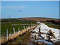
BN2 6QR offers a mix of retail and transport hubs within easy reach. Nearby shops include Co-op Warren, Tesco Woodingdean, and Morrisons Daily, providing essentials for daily living. The three railway stations—Falmer, Moulsecoomb, and London Road—connect residents to Brighton’s cultural and commercial centres, as well as London. The area’s proximity to the South Downs allows for walking, cycling, or hiking, with open landscapes offering a contrast to suburban living. The Woodingdean Water Well, a historic site, adds local interest, while the Brighton Racecourse provides event opportunities. This blend of convenience and natural access supports a lifestyle that balances practicality with leisure, making it suitable for families and professionals alike.
Amenities
Schools
| Rank | School | Type | Entry gender | Ages |
|---|
Explore more schools in this area
Go to Schools tabDemographics
BN2 6QR has a median age of 47, with the majority of residents aged 30–64. This reflects a mature, stable community where 88% of homes are owner-occupied, compared to the national average. The area is predominantly inhabited by White residents, with a focus on family households and long-term residents. The high home ownership rate suggests a settled population, less likely to move frequently. The absence of specific data on deprivation or diversity means the area’s social composition is not fully detailed, but the age profile indicates a balance between working-age adults and retirees. This demographic mix supports local amenities and services tailored to a range of needs, from schools to healthcare. The low population density, combined with a compact layout, creates a close-knit environment where neighbours are likely to know one another.
Household Size
Accommodation Type
Tenure
Ethnic Group
Religion
Household Composition
Age
Household Deprivation
NS-SEC
Explore more demographic insights in this area
Go to Demographics tabPlanning
Planning Constraints
- Flood RiskPremium
- Ramsar Wetland SitesPremium
- Area of Outstanding Natural BeautyPremium
- Protected Nature ReservePremium
- Protected WoodlandPremium