Area Overview for BN2 5EW
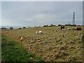
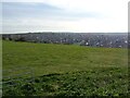
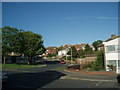
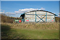
Photos of BN2 5EW
Area Information
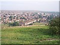
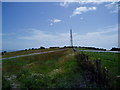
BN2 5EW is a small residential postcode in the east of Brighton, England, encompassing parts of Whitehawk and the Marina Ward. With a population of around 1,344, it is a compact area defined by post-industrial housing developments and proximity to the coast. The ward includes Whitehawk, a modern estate built in the 1920s and 1930s on former downland, and areas like Bristol Estate and Roedean. Its location within the Brighton and Hove City Council means it benefits from urban infrastructure while retaining historical significance, such as the Neolithic Whitehawk Camp. Daily life here balances suburban living with coastal access, with nearby amenities like railway stations and retail outlets. The area’s character is shaped by its history of social housing, including high-rises like Swanborough Flats, and community projects like the Crew Club and Whitehawk Inn. For buyers, BN2 5EW offers a mix of practicality and heritage, though its small size means proximity to the city’s amenities is key.
- Area Type
- Postcode
- Area Size
- Not available
- Population
- 1344
- Population Density
- 3664 people/km²
BN2 5EW is a housing estate with a focus on houses, though the exact mix of property types is not detailed. With a home ownership rate of 28%, the area leans more towards rental properties than owner-occupied homes, which may be typical for post-war council developments. This suggests that buyers should consider the market as potentially competitive for owner-occupiers, with limited availability of private homes. The presence of high-rises like Swanborough Flats, built in the 1960s, indicates a range of housing styles, though the small postcode area means the stock is concentrated. For buyers, the low home ownership percentage may reflect a reliance on rental options, but the proximity to Brighton’s amenities could make it appealing for those seeking affordable housing near the city. The area’s character as a former social housing estate may also influence property values and desirability.
House Prices in BN2 5EW
No properties found in this postcode.
Energy Efficiency in BN2 5EW
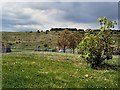
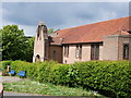
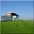
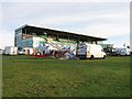
Living in BN2 5EW offers access to a range of amenities within walking distance. Retail options include M&S Royal, Co-op Whitehawk, and Lidl Kemp, providing everyday shopping needs. The area’s railway stations connect residents to Brighton’s cultural and commercial hubs, while nearby East Brighton Park offers green space for recreation. The Community Centre and library, opened in 1973, host local activities, and the historic Brighton Race Course adds a unique feature. The Blackrock gassworks, though industrial in origin, is a landmark of the area’s past. For leisure, the proximity to the sea and coastal walks enhances the lifestyle, though the area’s character is more suburban than coastal. The mix of retail, transport, and community facilities creates a practical, if unpretentious, daily life, with a focus on accessibility over luxury.
Amenities
Schools
| Rank | School | Type | Entry gender | Ages |
|---|
Explore more schools in this area
Go to Schools tabDemographics
BN2 5EW has a median age of 47, with the majority of residents aged 30–64. This suggests a community of middle-aged and older adults, likely including families and professionals. Home ownership is relatively low at 28%, indicating a higher proportion of renters, which may reflect the area’s history as a council estate. The accommodation type is predominantly houses, though the exact distribution of household types is not specified. The predominant ethnic group is White, though specific diversity statistics are not provided. The age profile implies a stable, established population, but the low home ownership rate may affect long-term residency patterns. For quality of life, the area’s moderate age range and historical housing stock suggest a mix of generational needs, though the lack of data on deprivation or income levels means broader socioeconomic context remains unclear.
Household Size
Accommodation Type
Tenure
Ethnic Group
Religion
Household Composition
Age
Household Deprivation
NS-SEC
Explore more demographic insights in this area
Go to Demographics tabPlanning
Planning Constraints
- Flood RiskPremium
- Ramsar Wetland SitesPremium
- Area of Outstanding Natural BeautyPremium
- Protected Nature ReservePremium
- Protected WoodlandPremium