Area Overview for BN2 4RY
Photos of BN2 4RY
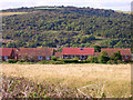
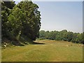
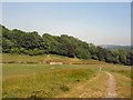
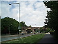
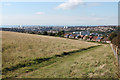
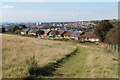
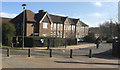

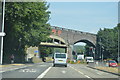
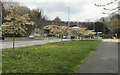
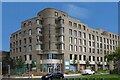
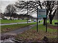
31 photos from this area
Area Information
Key information about the BN2 4RY including its size, population, and administrative classification.
- Area Type
- Postcode
- Area Size
- 1.0 hectares
- Population
- 1544
- Population Density
- 6034 people/km²
House Prices in BN2 4RY
45
Properties
£252,333
Average Sold Price
£157,000
Lowest Price
£300,000
Highest Price
Showing 45 properties
| Address | Type | Beds | Baths | Last Sale Price | Last Sale Date | |
|---|---|---|---|---|---|---|
| 111 Birdham Road, Brighton, BN2 4RY | Detached | 3 | 1 | £300,000 | Oct 2025 | |
| 65 Birdham Road, Brighton, BN2 4RY | house | 2 | 1 | £300,000 | Nov 2023 | |
| 115 Birdham Road, Brighton, BN2 4RY | house | 3 | - | £157,000 | Jan 2013 | |
| 77-83 Birdham Road, Brighton, BN2 4RY | Unknown | - | - | - | - | |
| 93-99 Birdham Road, Brighton, BN2 4RY | Unknown | - | - | - | - | |
| 85-91 Birdham Road, Brighton, BN2 4RY | Unknown | - | - | - | - | |
| 67 Birdham Road, Brighton, BN2 4RY | Detached | - | - | - | - | |
| 93 Birdham Road, Brighton, BN2 4RY | Flat | - | - | - | - | |
| 129 Birdham Road, Brighton, BN2 4RY | house | - | - | - | - | |
| 75 Birdham Road, Brighton, BN2 4RY | Detached | - | - | - | - |
Page 1 of 5
Energy Efficiency in BN2 4RY
Amenities
Schools
| Rank | School | Type | Entry gender | Ages |
|---|
Explore more schools in this area
Go to Schools tabDemographics
Household Size
Family (3-5 people)
most common
Accommodation Type
Houses
most common
Tenure
26
majority
Ethnic Group
White
most common
Religion
N/A
most common
Household Composition
N/A
most common
Age
47
median
Adults (30-64 years)
most common
Household Deprivation
N/A
with no deprivation
NS-SEC
16
in Lower managerial occupations
Explore more demographic insights in this area
Go to Demographics tabPlanning
Planning Constraints
- Flood RiskPremium
- Ramsar Wetland SitesPremium
- Area of Outstanding Natural BeautyPremium
- Protected Nature ReservePremium
- Protected WoodlandPremium