Area Overview for BN2 4BP
Photos of BN2 4BP
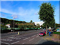
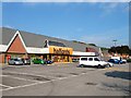
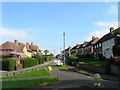
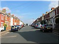
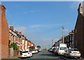
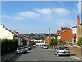
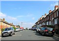
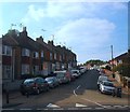
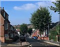
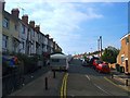
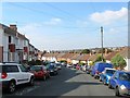
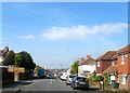
81 photos from this area
Area Information
Key information about the BN2 4BP including its size, population, and administrative classification.
- Area Type
- Postcode
- Area Size
- 6101 m²
- Population
- 1734
- Population Density
- 5630 people/km²
House Prices in BN2 4BP
24
Properties
£265,252
Average Sold Price
£41,000
Lowest Price
£425,000
Highest Price
Showing 24 properties
| Address | Type | Beds | Baths | Last Sale Price | Last Sale Date | |
|---|---|---|---|---|---|---|
| 74 Milner Road, Brighton, BN2 4BP | Terraced | 2 | 1 | £325,000 | Mar 2024 | |
| 68A Milner Road, Brighton, BN2 4BP | Flat | 2 | 1 | £144,339 | Sep 2023 | |
| 80 Milner Road, Brighton, BN2 4BP | Terraced | 4 | 1 | £410,000 | Aug 2023 | |
| 49 Milner Road, Brighton, BN2 4BP | Terraced | 4 | 1 | £425,000 | Jan 2023 | |
| 51 Milner Road, Brighton, BN2 4BP | Terraced | 2 | 1 | £380,000 | Jul 2022 | |
| First Floor Flat, 48 Milner Road, Brighton, BN2 4BP | Flat | - | - | £320,000 | Mar 2022 | |
| 84 Milner Road, Brighton, BN2 4BP | Flat | 1 | 2 | £360,000 | Sep 2021 | |
| 58 Milner Road, Brighton, BN2 4BP | Flat | 2 | 1 | £257,500 | Dec 2018 | |
| 70 Milner Road, Brighton, BN2 4BP | Terraced | 2 | 1 | £347,000 | Oct 2017 | |
| 86 Milner Road, Brighton, BN2 4BP | house | 5 | 1 | £420,000 | Sep 2016 |
Page 1 of 3
Energy Efficiency in BN2 4BP
Amenities
Schools
| Rank | School | Type | Entry gender | Ages |
|---|
Explore more schools in this area
Go to Schools tabDemographics
Household Size
Family (3-5 people)
most common
Accommodation Type
Houses
most common
Tenure
41
majority
Ethnic Group
White
most common
Religion
N/A
most common
Household Composition
N/A
most common
Age
22
median
Young Adults (15-29 years)
most common
Household Deprivation
N/A
with no deprivation
NS-SEC
18
in Lower managerial occupations
Explore more demographic insights in this area
Go to Demographics tabPlanning
Planning Constraints
- Flood RiskPremium
- Ramsar Wetland SitesPremium
- Area of Outstanding Natural BeautyPremium
- Protected Nature ReservePremium
- Protected WoodlandPremium