Area Overview for BN2 4BE
Photos of BN2 4BE
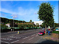
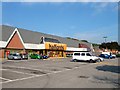
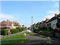
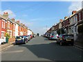
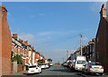
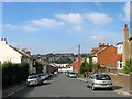
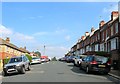
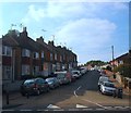
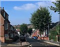
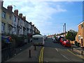
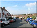
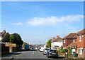
81 photos from this area
Area Information
Key information about the BN2 4BE including its size, population, and administrative classification.
- Area Type
- Postcode
- Area Size
- 7633 m²
- Population
- 1937
- Population Density
- 13451 people/km²
House Prices in BN2 4BE
30
Properties
£298,250
Average Sold Price
£71,500
Lowest Price
£407,000
Highest Price
Showing 30 properties
| Address | Type | Beds | Baths | Last Sale Price | Last Sale Date | |
|---|---|---|---|---|---|---|
| 43 Dewe Road, Brighton, BN2 4BE | Terraced | 2 | 1 | £340,000 | Nov 2023 | |
| 51 Dewe Road, Brighton, BN2 4BE | house | 2 | - | £407,000 | Jun 2022 | |
| 5 Dewe Road, Brighton, BN2 4BE | Terraced | 2 | 1 | £345,000 | Jun 2021 | |
| 21 Dewe Road, Brighton, BN2 4BE | Terraced | 2 | 1 | £311,000 | Jul 2020 | |
| 35 Dewe Road, Brighton, BN2 4BE | Terraced | 2 | 1 | £315,000 | Jan 2020 | |
| 37 Dewe Road, Brighton, BN2 4BE | Terraced | 2 | 1 | £71,500 | Mar 2000 | |
| 11 Dewe Road, Brighton, BN2 4BE | Terraced | 2 | 1 | - | - | |
| 55 Dewe Road, Brighton, BN2 4BE | Detached | - | - | - | - | |
| 15 Dewe Road, Brighton, BN2 4BE | house | - | - | - | - | |
| 9 Dewe Road, Brighton, BN2 4BE | house | - | - | - | - |
Page 1 of 3
Energy Efficiency in BN2 4BE
Amenities
Schools
| Rank | School | Type | Entry gender | Ages |
|---|
Explore more schools in this area
Go to Schools tabDemographics
Household Size
Family (3-5 people)
most common
Accommodation Type
Houses
most common
Tenure
40
majority
Ethnic Group
White
most common
Religion
N/A
most common
Household Composition
N/A
most common
Age
22
median
Young Adults (15-29 years)
most common
Household Deprivation
N/A
with no deprivation
NS-SEC
23
in Lower managerial occupations
Explore more demographic insights in this area
Go to Demographics tabPlanning
Planning Constraints
- Flood RiskPremium
- Ramsar Wetland SitesPremium
- Area of Outstanding Natural BeautyPremium
- Protected Nature ReservePremium
- Protected WoodlandPremium