Area Overview for BN2 3RE
Photos of BN2 3RE
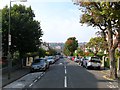
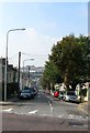
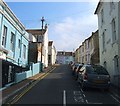
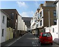
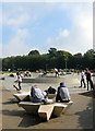
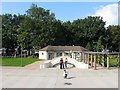
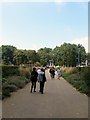
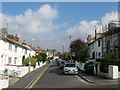
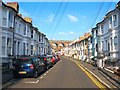
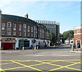
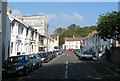
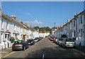
100 photos from this area
Area Information
Key information about the BN2 3RE including its size, population, and administrative classification.
- Area Type
- Postcode
- Area Size
- 5530 m²
- Population
- 1617
- Population Density
- 12140 people/km²
House Prices in BN2 3RE
41
Properties
£306,044
Average Sold Price
£58,995
Lowest Price
£575,000
Highest Price
Showing 41 properties
| Address | Type | Beds | Baths | Last Sale Price | Last Sale Date | |
|---|---|---|---|---|---|---|
| 26 Belton Road, Brighton, BN2 3RE | Terraced | 3 | 1 | £537,500 | Jan 2025 | |
| 42 Belton Road, Brighton, BN2 3RE | Terraced | 4 | 1 | £508,000 | Feb 2024 | |
| 1 Belton Road, Brighton, BN2 3RE | Terraced | 3 | 1 | £415,000 | Oct 2023 | |
| 23 Belton Road, Brighton, BN2 3RE | Flat | - | - | £300,000 | Jun 2023 | |
| 18 Belton Road, Brighton, BN2 3RE | Terraced | 4 | 1 | £575,000 | Jun 2022 | |
| 11 Belton Road, Brighton, BN2 3RE | house | - | - | £515,000 | Jan 2021 | |
| 46 Belton Road, Brighton, BN2 3RE | house | - | - | £548,000 | Jan 2021 | |
| 34 Belton Road, Brighton, BN2 3RE | house | - | - | £445,000 | Jan 2021 | |
| 29 Belton Road, Brighton, BN2 3RE | Terraced | 4 | 1 | £545,000 | Jan 2020 | |
| 32 Belton Road, Brighton, BN2 3RE | house | - | - | £414,000 | Sep 2018 |
Page 1 of 5
Energy Efficiency in BN2 3RE
Amenities
Schools
| Rank | School | Type | Entry gender | Ages |
|---|
Explore more schools in this area
Go to Schools tabDemographics
Household Size
Two person
most common
Accommodation Type
Houses
most common
Tenure
54
majority
Ethnic Group
White
most common
Religion
N/A
most common
Household Composition
N/A
most common
Age
47
median
Adults (30-64 years)
most common
Household Deprivation
N/A
with no deprivation
NS-SEC
43
in Lower managerial occupations
Explore more demographic insights in this area
Go to Demographics tabPlanning
Planning Constraints
- Flood RiskPremium
- Ramsar Wetland SitesPremium
- Area of Outstanding Natural BeautyPremium
- Protected Nature ReservePremium
- Protected WoodlandPremium