Area Overview for BN2 3PR
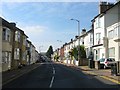
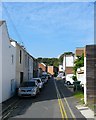
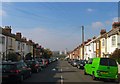
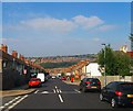
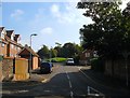
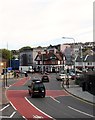
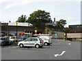
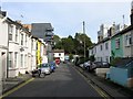
Photos of BN2 3PR
Area Information
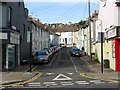
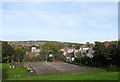
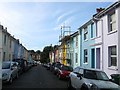
BN2 3PR is a small residential postcode area in Brighton, England, nestled on a steep hill northeast of the city centre. With a population of 1,880, it forms part of the Hanover & Elm Grove electoral ward, historically shaped by 19th-century developments like the Royal Sussex County Hospital and interwar council housing. The area’s character is defined by terraced homes, small shops, and public buildings, with a mix of working-class origins and more recent housing styles. Daily life here is steeped in local history, from the listed St Wilfrid’s Catholic Church to the remnants of the Elm Grove workhouse. Proximity to Brighton’s cultural and commercial hubs, combined with accessible rail links, makes it a practical choice for commuters. The area’s compact size means amenities are within practical reach, while its hillside location offers a distinct sense of community. For homebuyers, BN2 3PR balances historical charm with modern connectivity, though its small scale means housing options are limited to flats and semi-detached properties.
- Area Type
- Postcode
- Area Size
- Not available
- Population
- 1880
- Population Density
- 16014 people/km²
The property market in BN2 3PR is characterised by a high proportion of flats and a relatively low home ownership rate of 37%. This suggests the area is more rental-focused than owner-occupied, with limited scope for property investment in private ownership. The predominance of flats, combined with the area’s small size, means housing stock is constrained, and buyers must consider proximity to amenities and transport. The presence of interwar semi-detached council housing adds to the diversity of property types, though newer developments are scarce. For homebuyers, the challenge lies in navigating a competitive rental market, with limited opportunities for long-term equity growth. The area’s compact nature also means that properties are often part of larger estates, requiring buyers to evaluate not just the home itself but its integration into the surrounding community.
House Prices in BN2 3PR
No properties found in this postcode.
Energy Efficiency in BN2 3PR
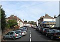
Life in BN2 3PR is shaped by its proximity to essential amenities and a mix of historical and modern features. Residents have access to five retail outlets, including Co-op Lewes and Sainsburys, ensuring everyday shopping needs are met. The area’s hillside location is complemented by nearby rail stations, which connect to Brighton’s cultural and commercial districts. The Royal Sussex County Hospital and listed churches add to the area’s character, while the small shops and public buildings on steep roads suggest a tight-knit community. The availability of both retail and transport options means daily life is convenient, with minimal need to travel beyond the immediate vicinity. For those who enjoy walking, the hillside setting offers a distinct aesthetic, though the terrain may pose challenges for some.
Amenities
Schools
Residents of BN2 3PR have access to two notable schools: Elm Grove Primary School, which holds a ‘good’ Ofsted rating, and Primary Annexe, though the latter’s specific type is not detailed. Elm Grove Primary School is a key asset for families, offering a reliable primary education within walking distance. The presence of a primary school with a positive rating indicates a focus on quality education, though the absence of secondary schools nearby may require students to commute. The mix of school types suggests a practical approach to education, with options for early years and primary learning. For families prioritising local schooling, Elm Grove’s rating is a significant advantage, but secondary education options are not explicitly listed in the area’s data.
| Rank | School | Type | Entry gender | Ages |
|---|
Explore more schools in this area
Go to Schools tabDemographics
BN2 3PR has a median age of 22, but the most common age range for residents is 30–64, indicating a mature, stable community. Home ownership here is relatively low at 37%, suggesting a rental-dominated market, with flats being the predominant accommodation type. The predominant ethnic group is White, reflecting the area’s historical roots as a working-class neighbourhood. This demographic profile implies a community focused on long-term residency and family life, with fewer transient populations. The lower home ownership rate may impact property values and investment potential, though it also means a higher proportion of residents are likely to be renters seeking affordability. The age distribution suggests a mix of established families and professionals, contributing to a balanced but not overly dynamic population.
Household Size
Accommodation Type
Tenure
Ethnic Group
Religion
Household Composition
Age
Household Deprivation
NS-SEC
Explore more demographic insights in this area
Go to Demographics tabPlanning
Planning Constraints
- Flood RiskPremium
- Ramsar Wetland SitesPremium
- Area of Outstanding Natural BeautyPremium
- Protected Nature ReservePremium
- Protected WoodlandPremium