Area Overview for BN2 3ND
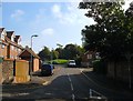
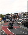
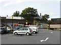
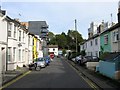
Photos of BN2 3ND
Area Information
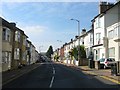
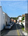
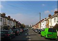
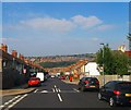
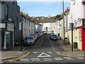
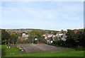
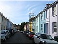
BN2 3ND is a small residential postcode in Brighton, England, nestled in the Hanover & Elm Grove electoral ward. With a population of 1770, it reflects a compact, tightly knit community on a steep hill northeast of Brighton’s city centre. The area’s character is shaped by its history of 19th-century development, including terraced housing and interwar council estates. Residents benefit from proximity to key landmarks like the Royal Sussex County Hospital, once a workhouse, and listed churches such as St Wilfrid’s Catholic Church. Daily life here is defined by a mix of residential tranquillity and accessibility to urban amenities. The area’s steep terrain and historic infrastructure create a distinct identity, blending older housing stock with modern conveniences. For those seeking a balance between suburban calm and city connectivity, BN2 3ND offers a unique blend of heritage and practicality, with nearby rail links and retail hubs within walking distance.
- Area Type
- Postcode
- Area Size
- Not available
- Population
- 1770
- Population Density
- 18971 people/km²
The property market in BN2 3ND is characterised by a 46% home ownership rate, suggesting a mix of owner-occupied and rental properties. The area’s accommodation type is predominantly houses, though the density of housing stock is not specified. Given its small size and residential focus, the market likely features a range of terraced and semi-detached homes, some of which date back to the 19th and early 20th centuries. The interwar council housing and Pankhurst Avenue estate add to the diversity of property types. Buyers should consider that the area’s compact nature means competition for properties may be fierce, particularly near key amenities like schools and transport links. For those prioritising ownership, the moderate home ownership rate indicates potential opportunities, though rental demand could also be strong due to the area’s accessibility to Brighton’s urban core.
House Prices in BN2 3ND
No properties found in this postcode.
Energy Efficiency in BN2 3ND
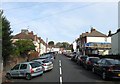
Daily life in BN2 3ND is enriched by nearby amenities, including five retail outlets such as Co-op Lewes, Sainsburys Lewes, and M&S University Brighton BP. These shops provide essential services and convenience for residents. The area’s steep hillside location offers a distinct character, with small shops, public buildings, and historic sites like the Royal Sussex County Hospital. While parks and leisure facilities are not explicitly listed, the proximity to Brighton’s urban core suggests access to broader recreational opportunities. The mix of retail, transport, and historic features contributes to a lifestyle that balances local convenience with urban connectivity, making it suitable for those who value both community and accessibility.
Amenities
Schools
Residents of BN2 3ND have access to two primary schools: Fairlight Junior School and Fairlight Infant School. Both institutions serve the local community, providing education for younger children. The presence of two primary schools within the area suggests a focus on early education, though no secondary schools are listed in the data. For families, this means proximity to foundational schooling, though additional research would be required to assess secondary options nearby. The schools’ specific performance ratings are not included, but their existence supports the area’s appeal to households with children. The mix of primary schools ensures coverage for early years education, complementing the area’s residential character and accessibility to other amenities.
| Rank | School | Type | Entry gender | Ages |
|---|
Explore more schools in this area
Go to Schools tabDemographics
BN2 3ND has a median age of 22, though the most common age range among residents is 30–64 years, suggesting a mix of younger and middle-aged households. Home ownership in the area stands at 46%, indicating a moderate balance between owner-occupied and rental properties. The predominant accommodation type is houses, though the exact distribution of household types is not specified. The area’s population is predominantly White, reflecting broader demographic trends in Brighton. While no explicit data on deprivation is provided, the low crime risk score of 92 (a 100-scale measure) implies a relatively stable and safe environment. This stability, combined with the area’s proximity to schools and transport, may support a quality of life that appeals to families and professionals seeking a manageable, community-oriented lifestyle.
Household Size
Accommodation Type
Tenure
Ethnic Group
Religion
Household Composition
Age
Household Deprivation
NS-SEC
Explore more demographic insights in this area
Go to Demographics tabPlanning
Planning Constraints
- Flood RiskPremium
- Ramsar Wetland SitesPremium
- Area of Outstanding Natural BeautyPremium
- Protected Nature ReservePremium
- Protected WoodlandPremium