Area Overview for BN2 3JT
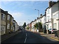
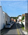
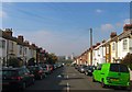
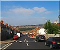
Photos of BN2 3JT
Area Information
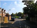
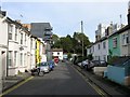
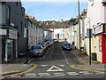
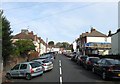
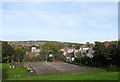
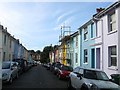
BN2 3JT is a small residential cluster within Brighton and Hove, situated on the northern slopes of the South Downs. With a population of 1,960, it reflects a suburban district that evolved from rural farmland into a structured residential area. The ward is defined by Victorian and early 20th-century housing, including terraced and semi-detached properties, many of which fall under the Round Hill Conservation Area. This designation highlights its architectural and historical significance, preserving the character of planned suburban expansion from the 1820s onwards. The area’s proximity to Brighton’s historic town centre, combined with its conservation status, creates a unique blend of residential tranquillity and historical interest. Daily life here is shaped by its mix of period homes, local amenities, and transport links. Residents benefit from nearby rail stations and a range of retail options, while the surrounding South Downs offer recreational opportunities. The area’s compact size and distinct identity make it a focal point for those seeking a balance between urban convenience and suburban charm.
- Area Type
- Postcode
- Area Size
- Not available
- Population
- 1960
- Population Density
- 20103 people/km²
The property market in BN2 3JT is characterised by a 34% home ownership rate, with flats making up the majority of accommodation types. This suggests a rental market that caters to students, young professionals, and those seeking short-term housing. The area’s housing stock consists largely of Victorian and Edwardian-era properties, many of which are protected under the Round Hill Conservation Area status. These historic homes, while offering charm, may present challenges for buyers seeking modern amenities or larger spaces. The compact size of BN2 3JT means property availability is limited, and proximity to Brighton’s town centre adds to its appeal. For buyers, this area is more suited to those prioritising location and historical character over extensive property choice. The rental market’s dominance also implies potential for investment, though buyers should consider the area’s transient nature when evaluating long-term value.
House Prices in BN2 3JT
No properties found in this postcode.
Energy Efficiency in BN2 3JT
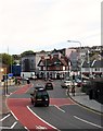
Living in BN2 3JT offers access to a range of local amenities within practical reach. Retail options include Co-op Lewes, Sainsburys Lewes, and M&S University Brighton BP, providing everyday shopping convenience. The area’s rail stations—London Road, Moulsecoomb, and Preston Park—connect residents to Brighton’s broader transport network, enabling easy access to the city’s cultural, educational, and commercial hubs. While the immediate vicinity is residential, the proximity to Brighton ensures residents can enjoy the city’s dining, entertainment, and leisure opportunities. The area’s historic character, combined with its transport links, creates a lifestyle that balances suburban comfort with urban accessibility. Parks and open spaces in the surrounding South Downs add to the appeal, offering recreational options for residents. The mix of local shops, transport, and historical context makes BN2 3JT a practical choice for those seeking a connected yet community-focused environment.
Amenities
Schools
| Rank | School | Type | Entry gender | Ages |
|---|
Explore more schools in this area
Go to Schools tabDemographics
BN2 3JT has a median age of 22, with the most common age range being 15–29 years. This suggests a community skewed towards young adults, likely including students and early-career professionals. Home ownership here is relatively low at 34%, indicating a rental-dominated market. The predominant accommodation type is flats, reflecting a preference for smaller, urban-style living. The area’s demographic profile is largely shaped by its proximity to Brighton’s universities, which may attract younger residents. The predominant ethnic group is White, though specific diversity data is not provided. The low home ownership rate and young population profile suggest a transient community, with residents potentially prioritising flexibility over long-term investment. This dynamic influences local services and amenities, which cater to a younger demographic with distinct needs.
Household Size
Accommodation Type
Tenure
Ethnic Group
Religion
Household Composition
Age
Household Deprivation
NS-SEC
Explore more demographic insights in this area
Go to Demographics tabPlanning
Planning Constraints
- Flood RiskPremium
- Ramsar Wetland SitesPremium
- Area of Outstanding Natural BeautyPremium
- Protected Nature ReservePremium
- Protected WoodlandPremium