Area Overview for BN2 3JL
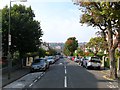
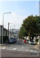
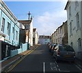
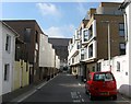
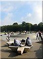
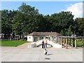
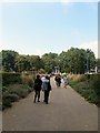
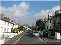
Photos of BN2 3JL
Area Information
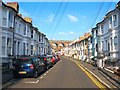
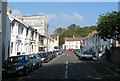
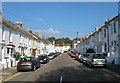
BN2 3JL is a small residential postcode in Brighton and Hove, England, home to around 1,730 people. Situated on the northern slopes of the South Downs, it reflects Brighton’s historical northward expansion, with Victorian and Edwardian architecture defining its character. The area’s development began in the 1820s, shaped by the arrival of the Brighton, Lewes and Hastings Railway Line in the 1830s. Today, it retains a structured suburban feel, with terraced and semi-detached properties arranged in planned layouts. Conservation area status protects its historic buildings, including Round Hill Crescent’s stuccoed houses from 1865. Residents benefit from proximity to primary schools like Bevendean Junior School and easy rail access to London Road and Preston Park stations. The area’s mix of older housing stock and modern amenities creates a distinct suburban identity, appealing to those seeking a blend of heritage and practicality.
- Area Type
- Postcode
- Area Size
- Not available
- Population
- 1730
- Population Density
- 13442 people/km²
The property market in BN2 3JL is characterised by a 35% home ownership rate, indicating a rental-dominated market. Flats are the primary accommodation type, a legacy of the area’s 19th-century suburban planning. This suggests limited availability of owner-occupied homes, with many properties likely part of larger residential blocks or purpose-built flats. The conservation area status adds value to historic properties but may restrict modernisations. For buyers, this means competition for flats in a small area, with prices potentially influenced by proximity to schools and rail links. The market is likely more attractive to investors or first-time buyers seeking affordable rental options rather than long-term ownership.
House Prices in BN2 3JL
No properties found in this postcode.
Energy Efficiency in BN2 3JL
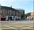
BN2 3JL offers a range of amenities within practical reach. Retail options include Co-op Co-o Brighton, Co-op Lewes, and Aldi Brighton, providing everyday shopping convenience. The area’s rail links to London Road and Preston Park stations connect residents to broader networks for commuting or leisure. Historic sites like the Jolly Brewers Inn and The Bear Inn add character, while the conservation area status preserves architectural heritage. The suburban layout balances accessibility with a quieter, structured environment. Residents can enjoy a mix of practical amenities and historical charm, supporting both daily needs and a sense of place.
Amenities
Schools
BN2 3JL is served by two primary schools: Bevendean Junior School and Bevendean County Infant School. Both cater to younger children, providing a foundation for families with school-age dependents. The presence of two primary schools within the area suggests a focus on early education, though no secondary schools are listed in the data. This mix supports families requiring primary schooling but may necessitate travel for secondary education. The schools’ proximity to residential areas enhances the area’s appeal for families prioritising accessible education.
| Rank | School | Type | Entry gender | Ages |
|---|
Explore more schools in this area
Go to Schools tabDemographics
BN2 3JL has a median age of 22, with the majority of residents aged 15–29. This young demographic is reflected in the 35% home ownership rate, suggesting a high proportion of renters, likely students or young professionals. The accommodation type is predominantly flats, aligning with the area’s historic development patterns. The predominant ethnic group is White, though no specific data on diversity or deprivation is provided. The low median age indicates a dynamic, possibly transient population, which may influence local services and amenities. For buyers, this profile suggests a community focused on affordability and accessibility, with housing demand driven by proximity to education and transport.
Household Size
Accommodation Type
Tenure
Ethnic Group
Religion
Household Composition
Age
Household Deprivation
NS-SEC
Explore more demographic insights in this area
Go to Demographics tabPlanning
Planning Constraints
- Flood RiskPremium
- Ramsar Wetland SitesPremium
- Area of Outstanding Natural BeautyPremium
- Protected Nature ReservePremium
- Protected WoodlandPremium